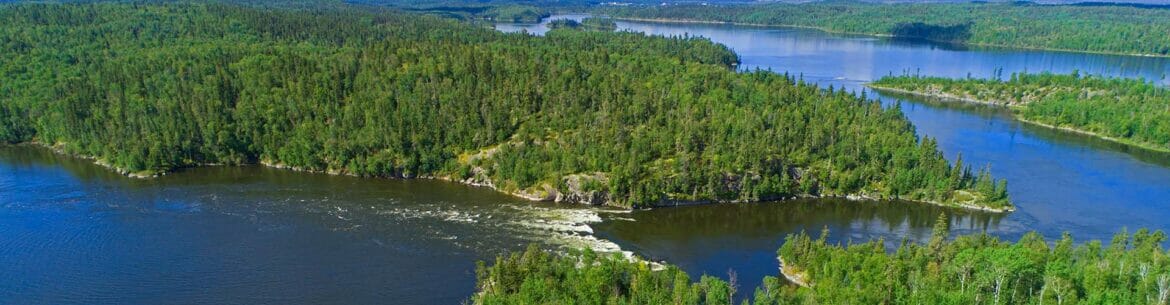
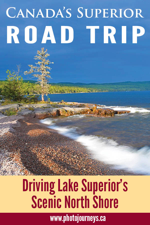
It ranks among Canada’s most iconic road trips. The north shore of Lake Superior reveals Canadian Shield at its finest, a wild land of forest, rivers, and rugged rock formations, yet it is easily accessible along the Trans Canada Highway. While the dramatic terrain prompts us to drive this route, the experience also brings home how this sparsely populated landscape figures so large in the Canadian experience – the glory days of the fur trade to the heyday of the Group of Seven painters, Stompin’ Tom ballads, the courage and tragedy of Terry Fox, and Bill Mason films that popularized canoe culture and the beauty of untamed waterways. Even Winnie-the-Pooh.
The Trans Canada Highway stretches just over 700 km from the Lakehead at Thunder Bay to Sault Ste. Marie at the lake’s eastern end. Some travellers drive it in one ridiculously long day. Others stop for a night or more along the way. We took two weeks, though it felt as if we had just skimmed the surface.
Thunder Bay and Sleeping Giant
Located near the western end of Lake Superior, Thunder Bay is best known as the terminus for the St. Lawrence Seaway System. Hundreds of ships traverse the seaway annually, carrying western Canadian grain and other products bound for European markets and beyond.
The City of Thunder Bay has only existed since 1970 when the cities of Fort William and Port Arthur amalgamated and took on a new name. When the fur trade dominated Canada’s economy, Fort William was at the centre of it all, providing a crucial link between east and west.
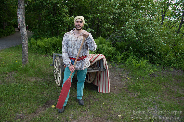
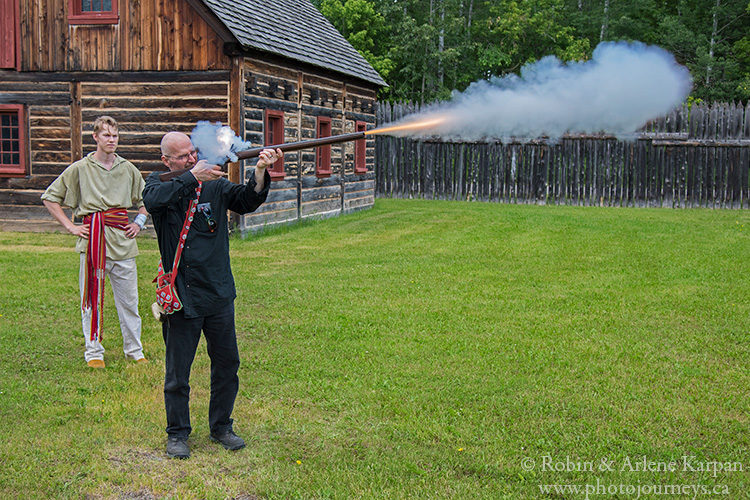
To get in touch with this bygone era we head to Fort William Historical Park, billed as the World’s Largest Fur Trade Post and one of the largest living history attractions in North America. Covering 250 acres, the fort recreates life in 1816 at this strategic North West Company post. Interpreters in period dress relate stories of voyageurs and Metis traders, and bring to life the important roles of blacksmiths, tinsmiths, and coopers, among many others. Even after spending several hours, we feel we could have stayed longer. What’s not to like about a place that lets visitors throw axes and fire muzzle-loading muskets?
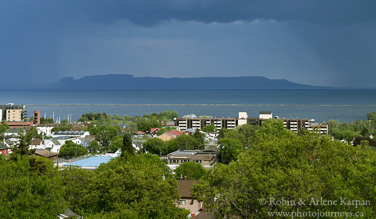
The most impressive part of Thunder Bay is its setting, looking over the massive lake with the equally massive Sleeping Giant formation looming in the distance. What seems like an island at first glance is the end of a long peninsula where the rocky terrain suddenly rises at the end to resemble a giant lying on his back, arms folded on his chest.
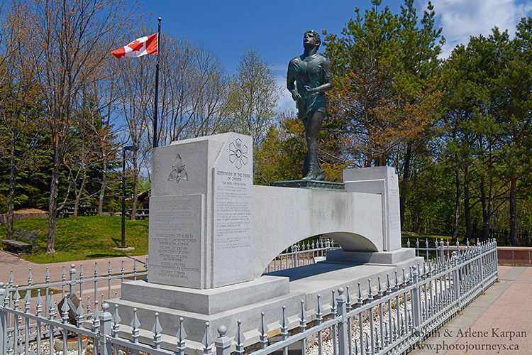
Heading east from Thunder Bay, we soon come to the spot where Terry Fox was forced to end his Marathon of Hope in 1980. The courageous one-legged runner made headlines as he attempted to run across Canada to raise funds for cancer research. After completing over 5,300 km, his cancer spread, and he died less than a year later. The Terry Fox Monument features a large bronze statue and tells the story of his remarkable achievements.
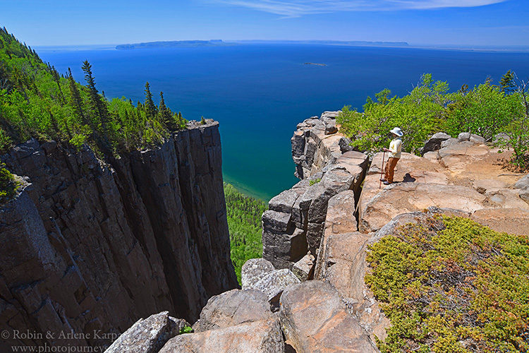
Before long we come to the turnoff to Sleeping Giant Provincial Park. Time to check out the big guy. The park boasts over 100 km of hiking trails, but our main goal is to do the Top of the Giant Trail, a 23-km return trek rated as difficult. It starts off easy enough following the lakeshore but becomes rougher as we head inland.
Then a rather ominous sign warns that the next section is “extreme”. It’s all uphill from here as the trail zigzags over uneven boulders through the forest until we emerge on top of the giant’s knees. Just over a few more outcroppings, we reach trail’s end next to a gaping gorge that drops into oblivion on the edge of Lake Superior, the vertical cliffs so straight that they seem to have been cut by a precision machine. The breathtaking view more than makes up for the long tiring trek.
Nipigon and Parks of the North Shore
The town of Nipigon sits at the northernmost extent of Lake Superior, where the Nipigon River flows into the great lake. Driving into town, we follow signs to Paddle to the Sea Park, dominated by a larger-than-life replica of the toy boat featured in the famous movie.
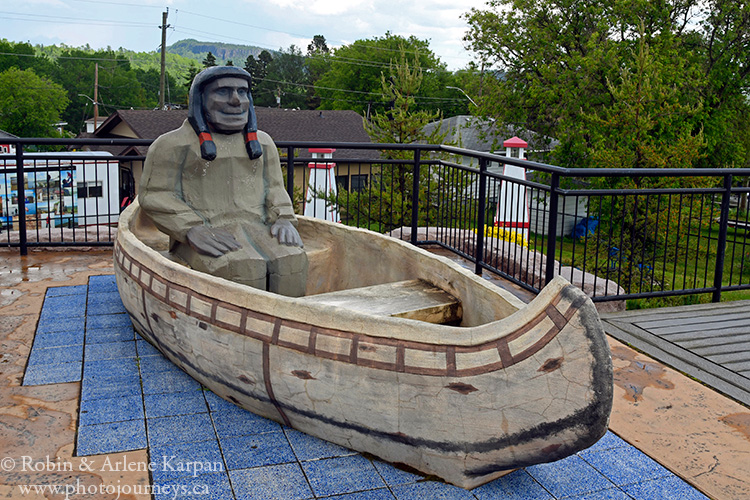
Filmmaker and canoeing guru, Bill Mason, was enamoured with Lake Superior, using it as a setting for many of his National Film Board productions. Paddle to the Sea, nominated for a 1968 Academy Award for the Best Short Film, tells of a Nipigon-area boy who carves a wooden toy canoe then sets it afloat to travel the waterways to the sea.
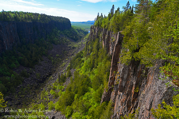
Provincial parks line Superior’s north shore. Ouimet Canyon, a short detour inland, offers sweeping views over a 150-metre-wide gorge where sheer cliffs drop 100 metres to the canyon floor. Despite the magnificent scenery, it’s far enough off the highway that it doesn’t attract the same traffic as other parks. On the day we visit, we follow the short trail along the canyon rim and discover that we have this impressive place all to ourselves.
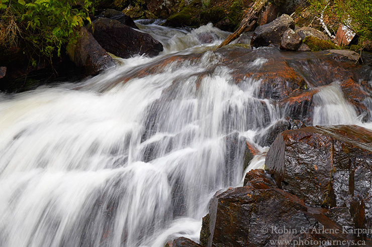
Rainbow Falls Provincial Park has two sections, each quite different. Just inland from Lake Superior, Rainbow Falls starts at the outlet of Whitesand Lake, then tumbles over so many drops that we can’t see them all at once. A short scenic trail along a series of stairways skirts the water’s edge, giving us access to several different places for closeup waterfall photography.
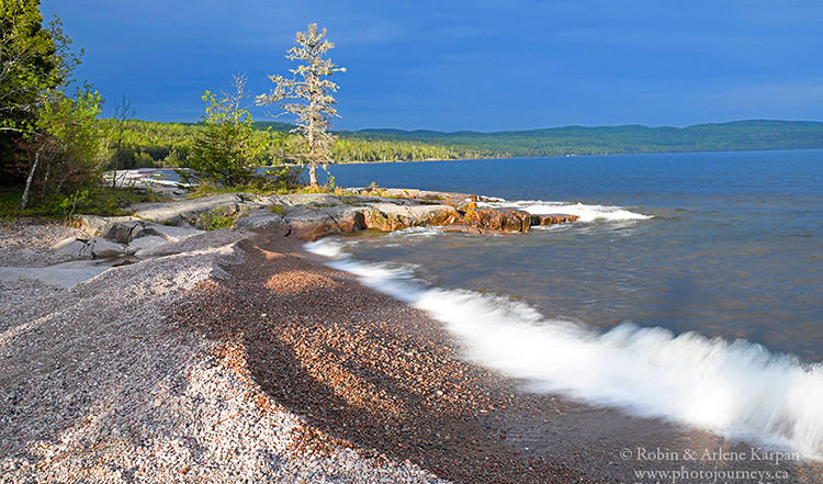
To spend the night, we opt for the park’s other section – the small Rossport Campground right on the shore of Lake Superior. The beach is a mix of sand and pebbles with dazzling colours, interspersed with rocky outcroppings jutting into the lake. Add the scattering of trees on the shore and we almost feel that we’re part of a Group of Seven painting. Low-hanging storm clouds threaten rain, but just before dark the evening sun peeks through the clouds, washing a warm magical glow across the beach, leaving us with some of our favourite photos of the trip.
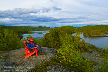
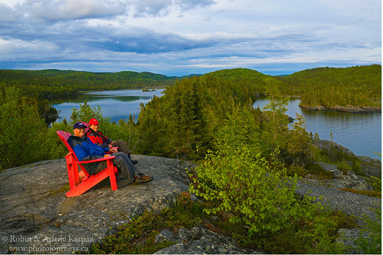
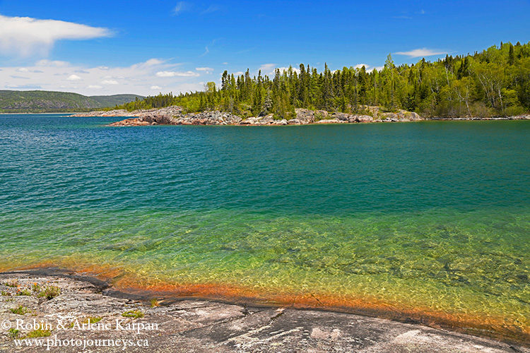
Another hour or so east we come to Neys Provincial Park, also on the lakeshore though looking different again. This park boasts some of Superior’s finest sand beaches, many strewn with massive jumbles of driftwood and colourful boulders. Hiking trails make it easy to explore the forest and many bays where the shallow water has an almost unreal turquoise tinge. A common saying is that Superior’s waters are reminiscent of the Caribbean – until you dip your toe in. One trail leads to the lookout point where Group of Seven artist Lawren Harris came to paint in the 1920s and created one of his most famous works – Pic Island.
At Prisoner’s Point, the crumbling remains of freighter scows date to a World War II prisoner-of-war camp. German soldiers were brought here because there was little chance of them escaping and rejoining the war. They were put to work in logging camps, then sent back to Germany at the end of the war. Some were so impressed by how well they were treated during their internment that they immigrated back to Canada.
Pukaskwa National Park
Just past the town of Marathon, a side road heads 15 km off the Trans Canada Highway to Pukaskwa National Park, a remote and natural wilderness gem. The road ends at Hattie Cove Campground and day-use area. From here, the only options are to walk or paddle to explore the park.
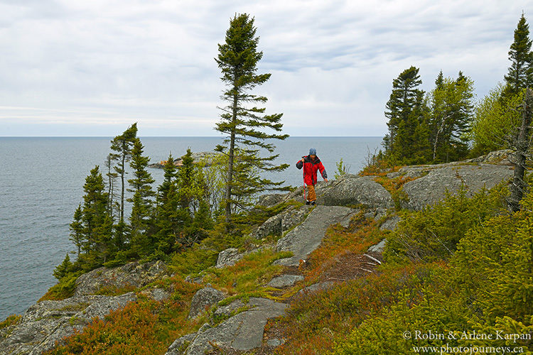
With 135 km of rugged coastline, the park is a mix of ancient granite bedrock, mixed forest, golden sand beaches, and stunning views at every turn. We take several outstanding day hikes across the peninsulas, beaches, and cliffs lining Hattie Bay. This is also the trailhead for the famous 60-km Coastal Hiking Trail, ranking among Canada’s premier backpacking routes.
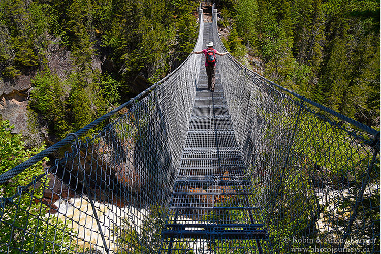
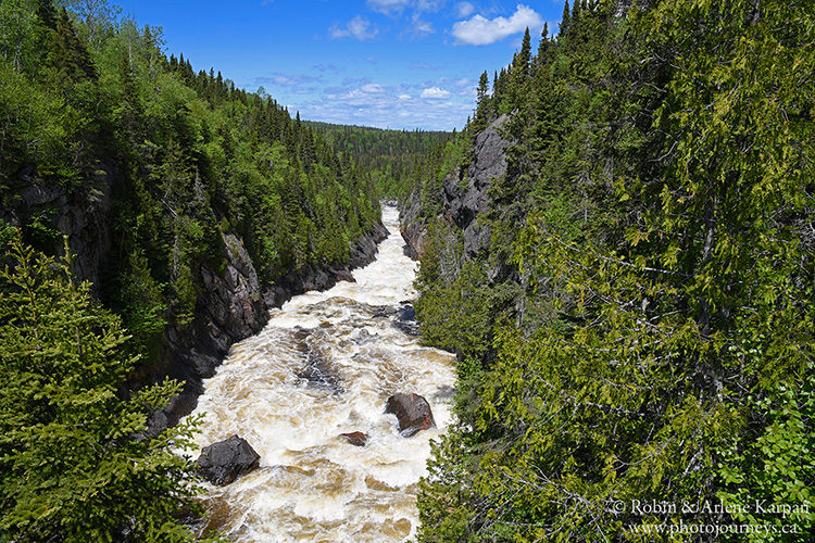
To get a taste for the route, we do an 18-km return day trip as far as the White River Suspension Bridge. The well-marked trail weaves in and out of the forest and beside the lakeshore. Then suddenly the silence is broken as we hear the crashing sound of water plunging down the narrow chasm. We emerge from the trees, step onto the edge of the bridge, and cautiously glance down 23 metres to frothing Chigamiwinigum Falls. It’s disconcerting looking through the open steel mesh floor of the 30-metre-long bridge, as we slowly work our way across and peer straight down into the churning water far below. As far as we can see in both directions, the White River roars and cascades down the deep gorge. Northern Ontario wilderness at its best.
While the Trans Canada Highway skirts Superior’s shore much of the way, shortly after we leave Marathon the road heads inland for around 190 km to go around Pukaskwa National Park. Along this stretch we stop at the town of White River where a statue and park commemorate the origins of Winnie-the-Pooh.
During World War I in 1914, when Lieutenant Harry Colebourn’s troop train stopped at White River, he purchased an orphaned black bear cub from a local trapper. He named her Winnie after his hometown, Winnipeg. The bear became a popular mascot for troops stationed in England, but when Colebourn was sent to France, he took Winnie to the London Zoo. The rest is history, as they say. Author A.A. Milne and his son Christopher Robin soon came along and turned Winnie-the-Pooh into the world’s most famous bear.
Wawa – Landmarks, Artists, and Fabulous Paddling
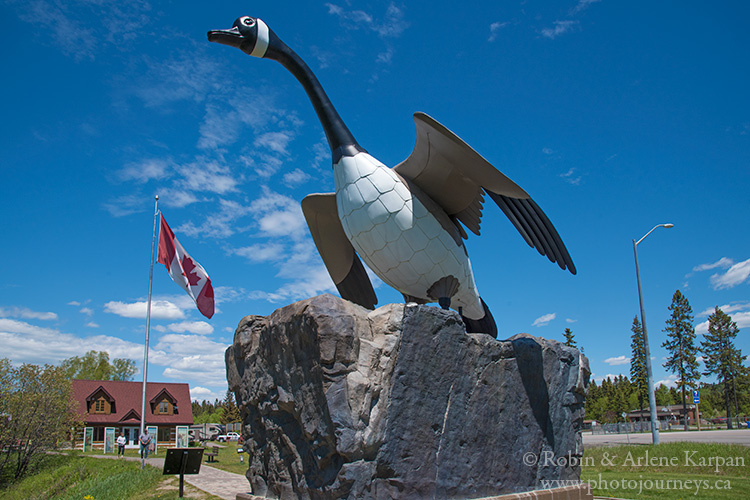
The highway returns to the Superior lakeshore near Wawa, home to the giant goose monument that is so famous that Stompin’ Tom Connors even wrote a song about it. As you take a gander around the visitor centre, look for the information panel with the lyrics to the tune, and feel free to sing along.
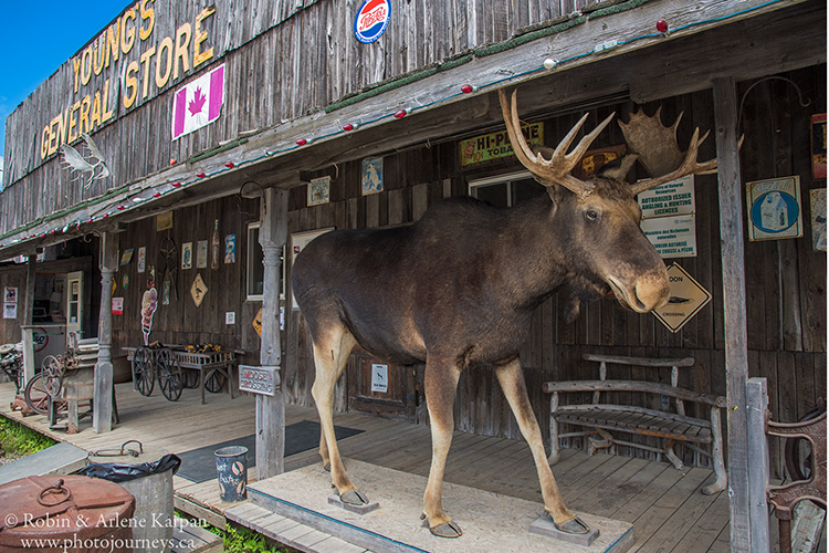
We take the short drive into town, and soon come to Wawa’s second mascot, a full-size stuffed and mounted moose on the porch of Young’s General Store. Inside is part store and part museum, chock-a-block with everything from a huge pickle barrel full of pickles to moose-hide gloves, fur hats, fishing lures, souvenirs, homemade fudge, and an ice cream stand. The dry summer sausage is some of the best we’ve had anywhere.
It’s not surprising that the landscapes around Wawa caught the eye of artists. We take a delightful tour led by local historian Johanna Rowe to places such as Sandy Beach where Group of Seven painter A.Y. Jackson had a cabin and captured this part of the Lake Superior shoreline in several works.
Music composer Glenn Gould often came to Scenic High Falls on the Magpie River for inspiration. He was a frequent visitor, always insisting on staying in a specific room in the Wawa Motor Inn, where he said he did some of his best composing.
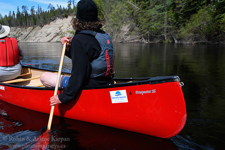
The best part of our Wawa visit is staying at Rock Island Lodge, on a gorgeous point jutting into Lake Superior at the mouth of the Michipicoten River. It’s home to Naturally Superior Adventures (NSA), specializing in canoeing and kayaking. One morning, NSA guide Brychan leads us on a half-day canoe trip down the Michipicoten River, starting upstream then paddling back to the lodge. It’s an easy-going stretch, being carried along the constant current through a series of twists and turns and fun Class 1 rapids.
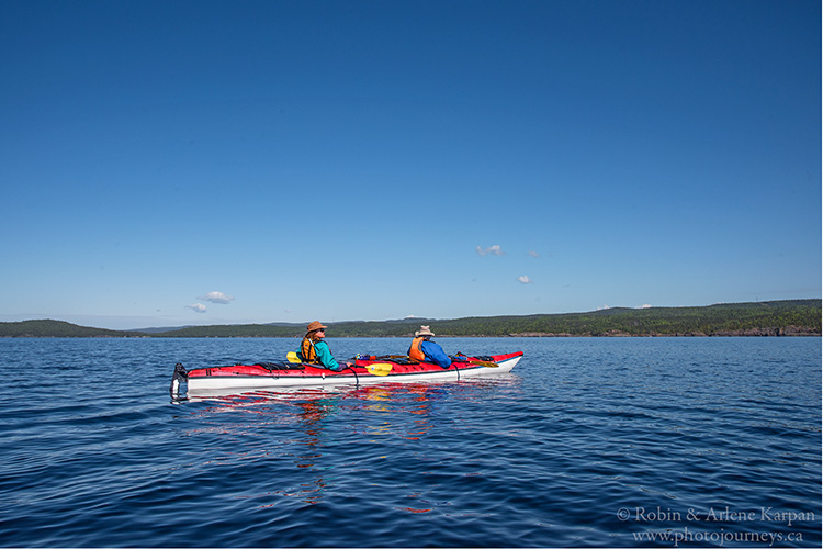
Next day, kayaking guide Andrea takes us out on Lake Superior in sea kayaks. Fortunately, calm waters prevail as we paddle leisurely around Michipicoten Bay, then to the cliffs near Sandy Beach. As impressive as Lake Superior may look from shore, nothing can compare with experiencing it out on the water.
Lake Superior Provincial Park
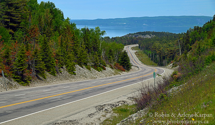
The last section of our route, from Wawa to Sault Ste. Marie, serves up one panoramic view after another. In 1960, this was the last place in the country to complete the Trans Canada Highway because of the challenge of finding a suitable route through the difficult terrain.
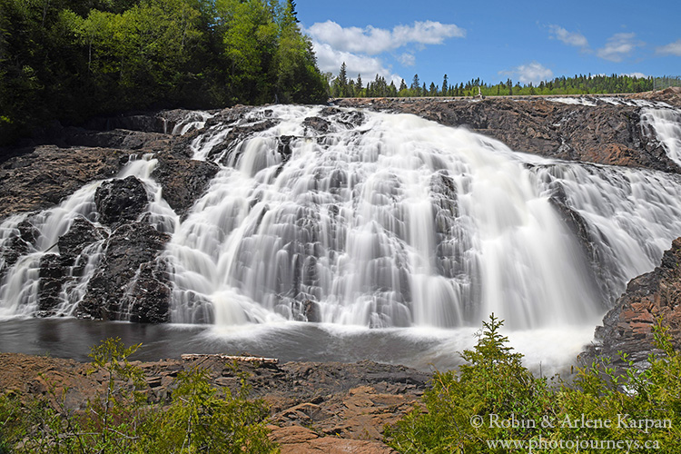
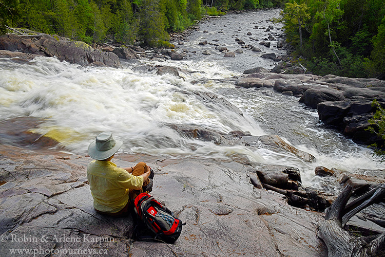
The highlight of this stretch is undoubtedly Lake Superior Provincial Park, an outdoor paradise with canoe routes, beaches, camping, scenic viewpoints, and hiking trails galore. The walk along the Sand River tops our list, as it follows a series of rapids and waterfalls along the wild waterway.
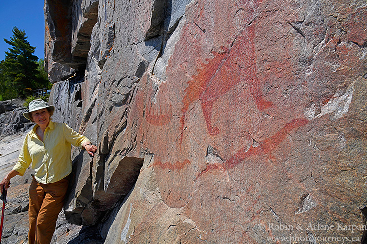
We save the best for last, and are relieved to find the lake quiet and peaceful as we take the short hike to the park’s renowned Agawa Pictographs on a cliff face at the water’s edge. Only when the lake is calm can we venture onto the slippery slope at the base of the cliff to see the ancient rock paintings. After almost sliding into the water along the smooth ledge, we take off our hiking boots and go barefoot, which provides just the grip we need to keep from slipping into the frigid lake.
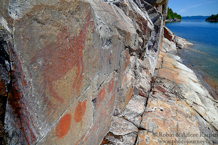
The vibrant red ochre images are thought to have been painted by Ojibway artists between 150 and 400 years ago. Some portray recognizable animals such as moose, bear, and caribou, or familiar items such as canoes. Then there are serpents and legendary creatures with horns and spines. One is thought to represent Misshepezhieu who could calm the waters or bring storms by thrashing his powerful tail.
These mysterious messages from the past seem a fitting finale to our journey as we look back on a trip filled with larger than life stories, outdoor adventure, and stunning scenery – all with a backdrop of the world’s largest lake.
SUBSCRIBE to Photojourneys below
Feel free to PIN this Article
Your travel photos are wonderful! I would love to see you visit Newfoundland
I’m sure that one day soon we will get there to explore the province, which is one of many places on our “bucket list”. Thanks for taking the time to comment.
Absolutely stunning pictures Mother Nature is certainly amazing and your photos captured it beautifully
Thanks for your comment Jeannie.
I am planning on doing this trip as soon as it warms up enough to camp.
Good luck, and we hope you have an enjoyable trip through spectacular scenery.