
While Hwy #11 is the quick and easy way to travel between Saskatoon and Regina, an alternate route just to the west takes you through significantly different countryside including sand hills, wildlife refuges, three provincial parks, one of the world’s largest earth-filled dams, impressive sand dunes, and southern Saskatchewan’s largest lake. Most of this route is paved, with the exception of a few access roads.
Chief Whitecap Trail
From Saskatoon, begin by taking Hwy #219 south, known as the Chief Whitecap Trail. About 13 km south of the city, you come to Beaver Creek Conservation Area where Beaver Creek meets the South Saskatchewan River. Displays in the interpretive centre introduce you to the flora and fauna you might see while walking the 8 km of trails that wind through natural prairie, forested valley slopes, along the meandering creek, and beside the sandy riverbank.
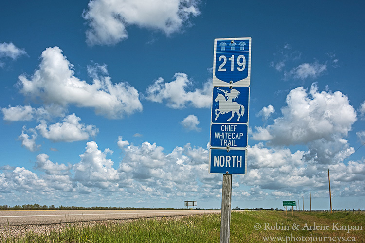
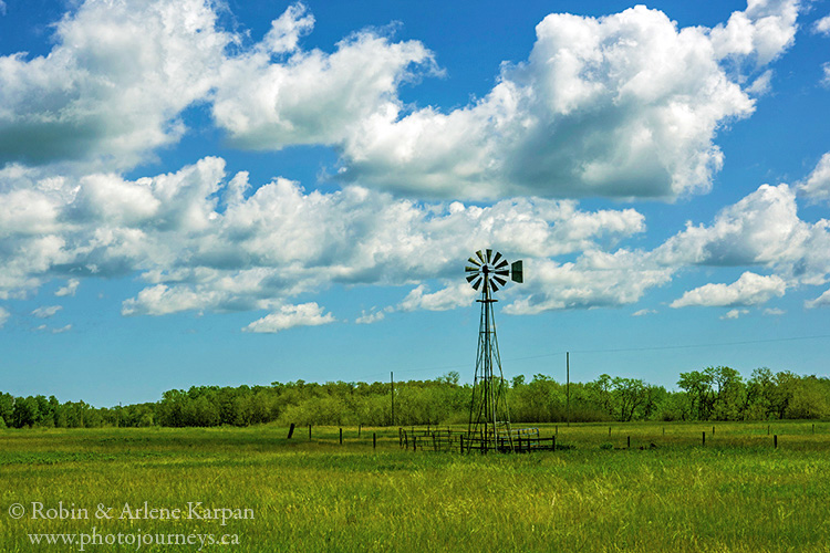
South of Beaver Creek on Hwy #219, the terrain is marked by hummocky sand hills with low shrubs and wooded coulees, and is mostly used for pasture. About 26 km south of Saskatoon, the highway passes through the Whitecap Dakota First Nation, famous for the Dakota Dunes Golf Links, rated among Canada’s top golf courses.
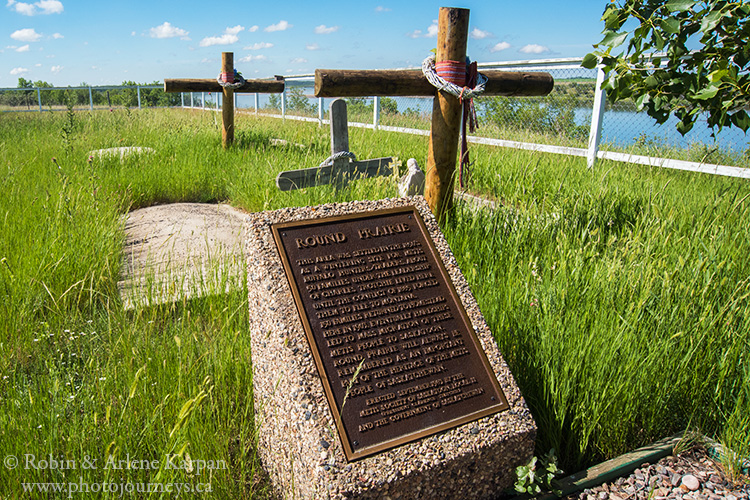
About 19 km south of Whitecap, watch for the turn-off to the west to Round Prairie Cemetery. The Round Prairie area was settled in the 1850s by Métis, and was one of the larger Métis settlements in Saskatchewan. All that remains today is the cemetery and small chapel. Besides the historic significance of Round Prairie, the site also provides spectacular views over the South Saskatchewan River valley.
Danielson Provincial Park
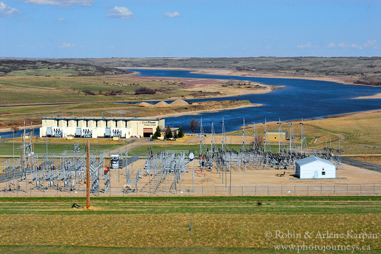
Hwy #219 crosses Hwy #15, passes beside the village of Glenside, then about 19 km farther south, makes a sharp turn to the west, ending at the junction with Hwy #44, just east of Gardiner Dam. To the west along Hwy #44, the road crosses Gardiner Dam and provides access to the west side of Danielson Provincial Park, including the visitor centre. This is also the start of the Circle Trip Around Lake Diefenbaker, which was the subject of an earlier posting. To continue south towards Regina or Moose Jaw, we turn south on Hwy #44 along Lake Diefenbaker’s east shore.
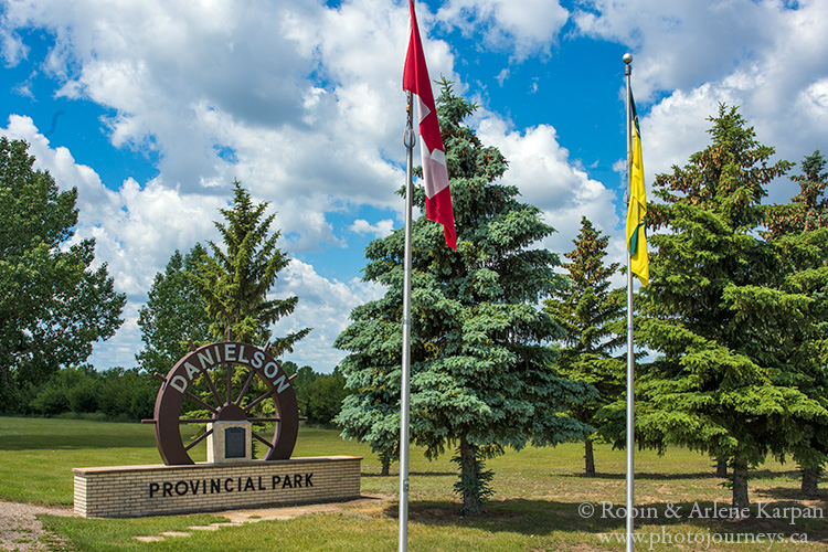
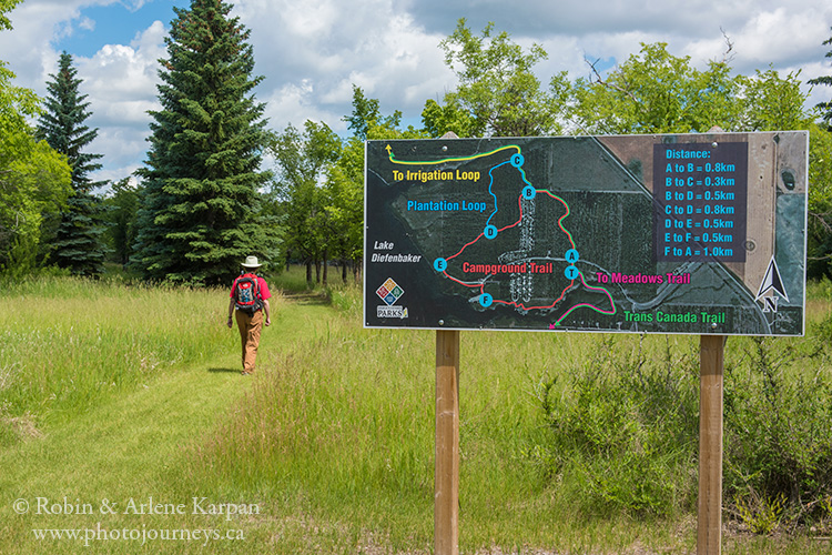
After going south for about 3.5 km, Hwy #44 passes the entrance to Danielson Provincial Park’s core area, with campgrounds, lake access, and hiking trails. The access road to the campground goes right beside the trailhead for many of the walks through prairie grasslands, woodland coulees, and lakeshore. Choose among short strolls, loop trails, and a 12.5 km section of the Trans Canada Trail.
Elbow and Area
Shortly after leaving Danielson Provincial Park, Hwy #44 heads east. At the junction with Hwy #19, head south past Loreburn to Elbow on the shore of Lake Diefenbaker. The main access road into Elbow (Saskatchewan St.) passes beside the town’s museum where you can see a fully furnished pioneer sod house. Keep going to the end of Saskatchewan St. and follow the signs to Elbow Harbor Recreation Site, just south of town.
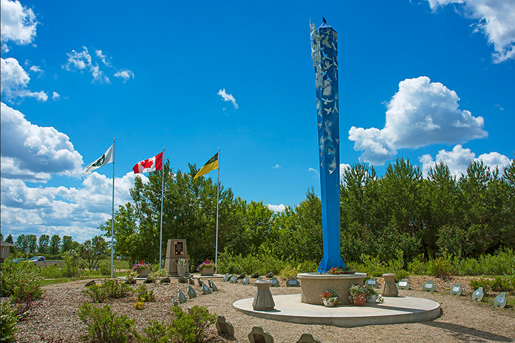
For a short detour on the way, turn right (northwest) at the first street after you cross the railway tracks (just look for the grain elevator). Across the road from the elevator is a large park area with an urban orchard, and impressive Peace Tower, crafted by acclaimed artist Joe Fafard.
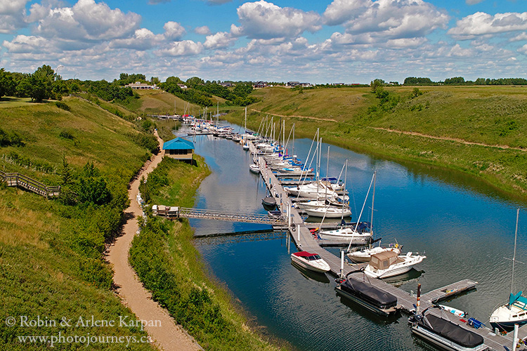
The recreation site is home to the Elbow Harbor Marina, a scenic cove that can accommodate large sailboats and yachts, and the Harbor Golf Club, a popular 18-hole grass green course with views over Lake Diefenbaker.
Douglas Provincial Park
A little southeast of Elbow, the highway runs through Douglas Provincial Park. The main access road into the park leads to the core area with campgrounds, picnic sites, beach, boat launch, and other services. You can explore the sandy lakeside landscape along the 2-km Sunset Trail, or set out on the much longer Trans Canada Trail that runs the length of the park near Lake Diefenbaker.
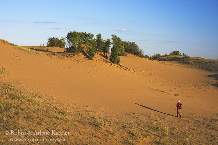
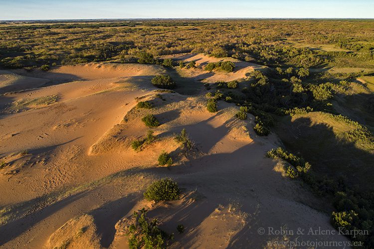
Two interconnected hiking trails begin directly across the highway from the core area – the Juniper Trail (2.5-km loop) and the Cacti Trail (6-km loop), passing through hummocky terrain with a mix of aspen trees and semi-open grasslands. Many plants have adapted to the dry conditions, including pincushion and prickly pear cactus. The best walk, however, is the spur trail about halfway around the Cacti Trail, which leads to the active sand dunes. From here you can walk through a vast area of rippled ridges, bowl-shaped blowouts, trees with exposed roots, and other dune features. We consider this exotic desert-like landscape to be the top attraction along this route, and something that shouldn’t be missed.
Continuing south on Hwy #19, watch for a pull-off and viewpoint over the Qu’Appelle Dam. This is where the Qu’Appelle River begins its journey across the province, meandering almost 500 km east to join the Assiniboine River just across the Saskatchewan–Manitoba border.
Just south of the dam, turn southeast on Hwy #367 to Tugaske and Eyebrow. Near Eyebrow, turn west on Hwy #42 which continues southeast through Brownlee, Keeler, Marquis, and Tuxford. At Tuxford, turn southeast onto Hwy #2, then turn west at the next intersection. This road soon meets Hwy #202 which continues west towards Buffalo Pound Provincial Park. Along the way, the road passes St. Columba’s Anglican Church, a tiny picture-perfect country church dating to 1898.
Buffalo Pound Provincial Park
Part of the Qu’Appelle River system, Buffalo Pound Lake was named for pounds where wild buffalo, or bison, used to be corralled. A hillside paddock is now home to small captive herd of bison, the only captive herd in a Saskatchewan park. Wildlife abounds in the park—everything from birds that frequent the marshes, grasslands and stands of mature forest, to deer and foxes, and pelicans, cormorants, and waterfowl that feed on the lake. Drive along the main roads to the boat launch, picnic sites, and campgrounds for excellent views over the picturesque valley lined with steep hills.
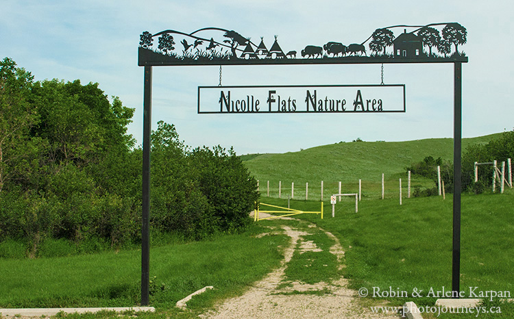
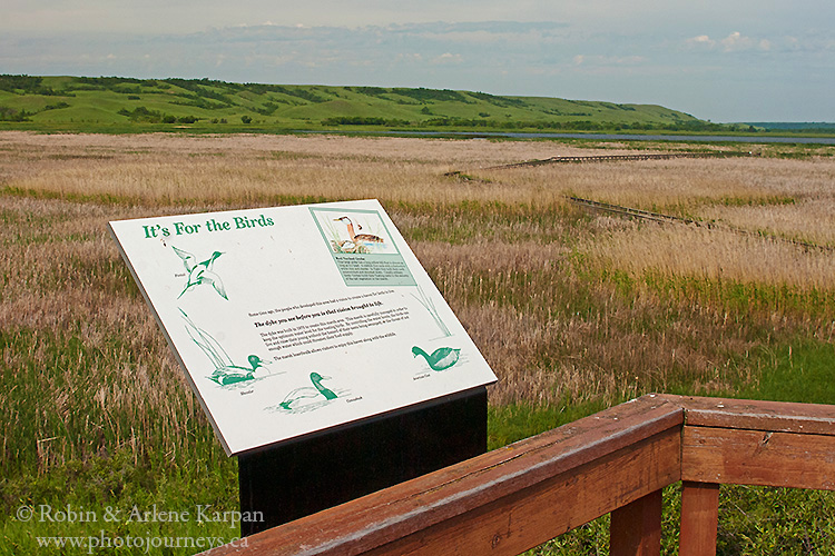
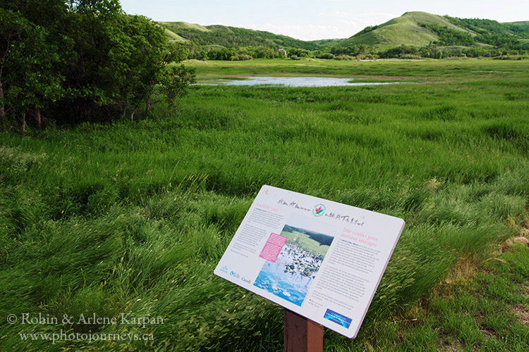
A highlight of the park is Nicolle Flats Marsh at the eastern end, reached by a 7-km road that begins near the park entrance and follows the lakeshore. A parking area between the east end of the lake and Nicolle Flats Marsh is the starting point for a wealth of walking trails through native prairie, beside the bison compound, to wetlands teeming with birdlife, and to the historic Nicolle Homestead nestled in the hills. You can walk right around the marsh (about 8 km), or take short hikes partway along. Don’t miss the boardwalk that goes right into the heart of the marsh where interpretive panels give you the lowdown on the plants, birds, and other critters found here.
After visiting Buffalo Pound Provincial Park, head south on Hwy #301 for 21 km to Hwy #1. From here it’s 5 km west to Moose Jaw, or about 65 km east to Regina.
For more details on this route as well as other great drives throughout Saskatchewan, check out our book Saskatchewan’s Best Scenic Drives.
SUBSCRIBE to Photojourneys below
Feel free to PIN this article



Well done. Opens your eyes as to how beautiful this Province of our is……
Thanks for your comment Gary. We’re glad that you enjoyed the article.
Adding this trip to our To Do list! Thank you for the inspiration.
Hope you enjoy this drive. Let us know how it goes.