
When travelling across the Canadian Rockies in British Columbia, Highway 3, the Crowsnest Highway, is a great alternative to the busy Trans-Canada Highway. This southerly route takes us from the Crowsnest Pass on the Alberta-BC border through non-stop mountain scenery and a series of inviting towns and small cities in the Kootenay Rockies.
Sparwood
The first community we come across is Sparwood, with a long history of mining in the Crowsnest Pass. An unusual attraction here is the world’s largest truck. Everything about it is gigantic. The tires alone stand 3 1/2 metres tall, and the box could hold two Greyhound buses plus two pick-up trucks.
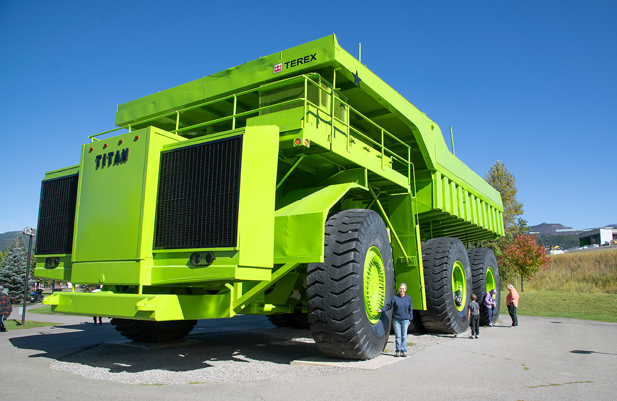
The Terex 33-19 Titan was built in 1973 by General Motors as a prototype, but it never went into full production. Titan served in the steel and coal mines near Sparwood before being retired in the 1990s and donated to the town as a tourist attraction.
Fernie
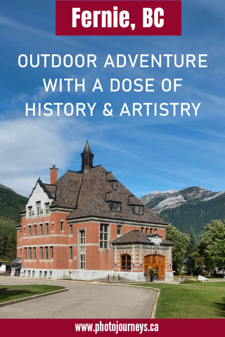
Our next stop, Fernie, stood out as one of our favourites along the route, so much so that we did a more detailed posting on the town. It’s known for its wealth of outdoor activities, and hiking and biking trails are so numerous and varied that it’s difficult to know where to begin.
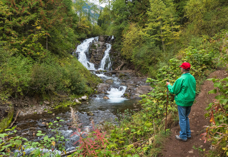
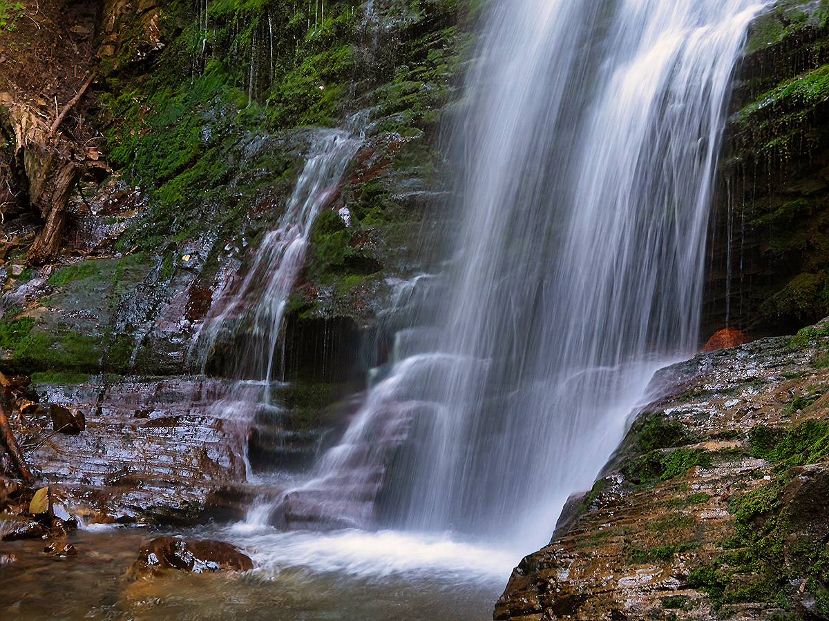
The short and easy hike to Fairy Creek Falls, following a picturesque creek valley to a nice waterfall, was a definite highlight. The trailhead for the five-kilometre return hike starts right beside the town’s visitor centre along the highway.
Fernie’s history shouldn’t be overlooked. We followed an historic walking tour to many town treasures, such as the unusual and ornate court house, and the old coal company offices now used as city hall.
Cranbrook
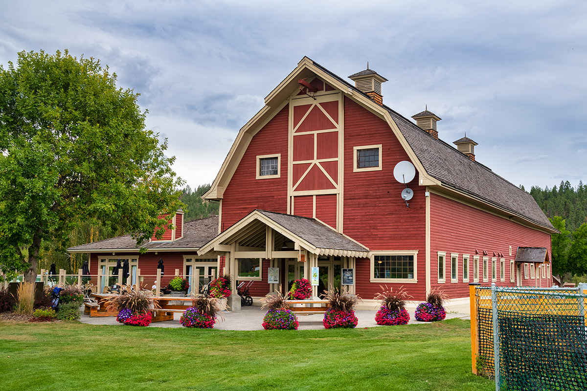
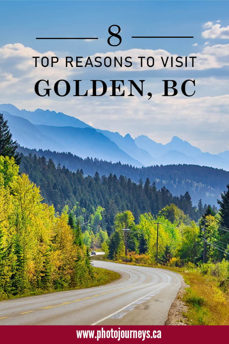
Cranbrook is the largest city in the Kootenay Rockies. With a scenic setting near the St. Mary River and Kootenay River, Cranbrook sits at a crossroads with east-west Highway 3 and Highway 93 heading north towards Kootenay National Park, Golden, and the Trans Canada Highway.
At St. Eugene Golf Resort just outside Cranbrook, a storied past combines with a successful present-day operation. Dating back to the late 1890s, the St. Eugene Mission with its stately stone and brick building was run as an Indian Residential School until it closed in 1970.
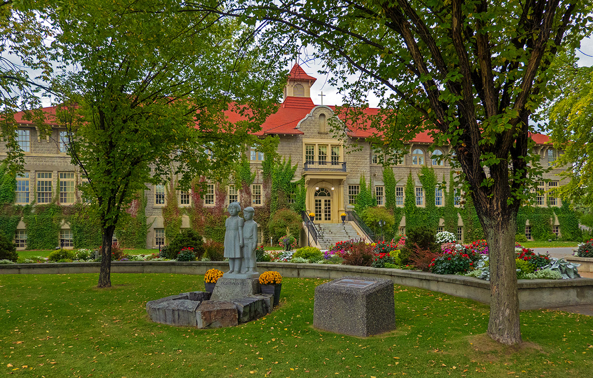
Almost everywhere in the country, Indigenous groups have been anxious to get rid of reminders of residential schools. However, here they adopted a different approach. The Ktunaxa people of the area, many of whom attended the school, acquired the building and grounds and turned it into a 4.5-star resort with a luxury hotel, casino and championship golf course.
At the resort’s interpretive centre, visitors can learn about Ktunaxa culture and tour the building with a former student for a behind-the-scenes look at what life was like at a residential school. Their philosophy is to take something negative and build it into something positive.
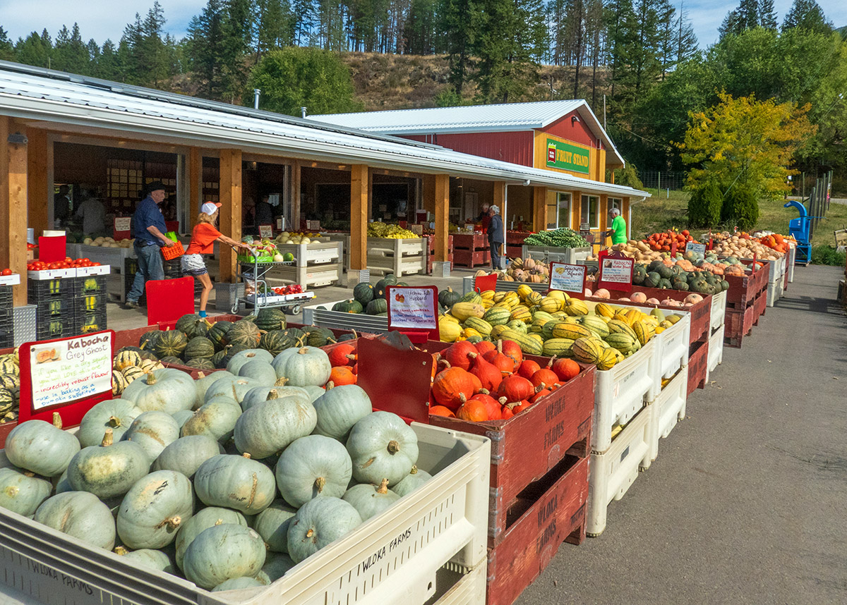
The Creston Valley
In addition to a wealth of mountain recreational possibilities, the town of Creston and the Creston Valley are in the agricultural heartland of the Kootenay region, with a mild climate and fertile soil on the broad valley flats. Produce and fruit markets spring up everywhere, along with an impressive array of wineries.
Driving through the centre of town, we were surprised to see two (soon to be one) classic prairie grain elevators.
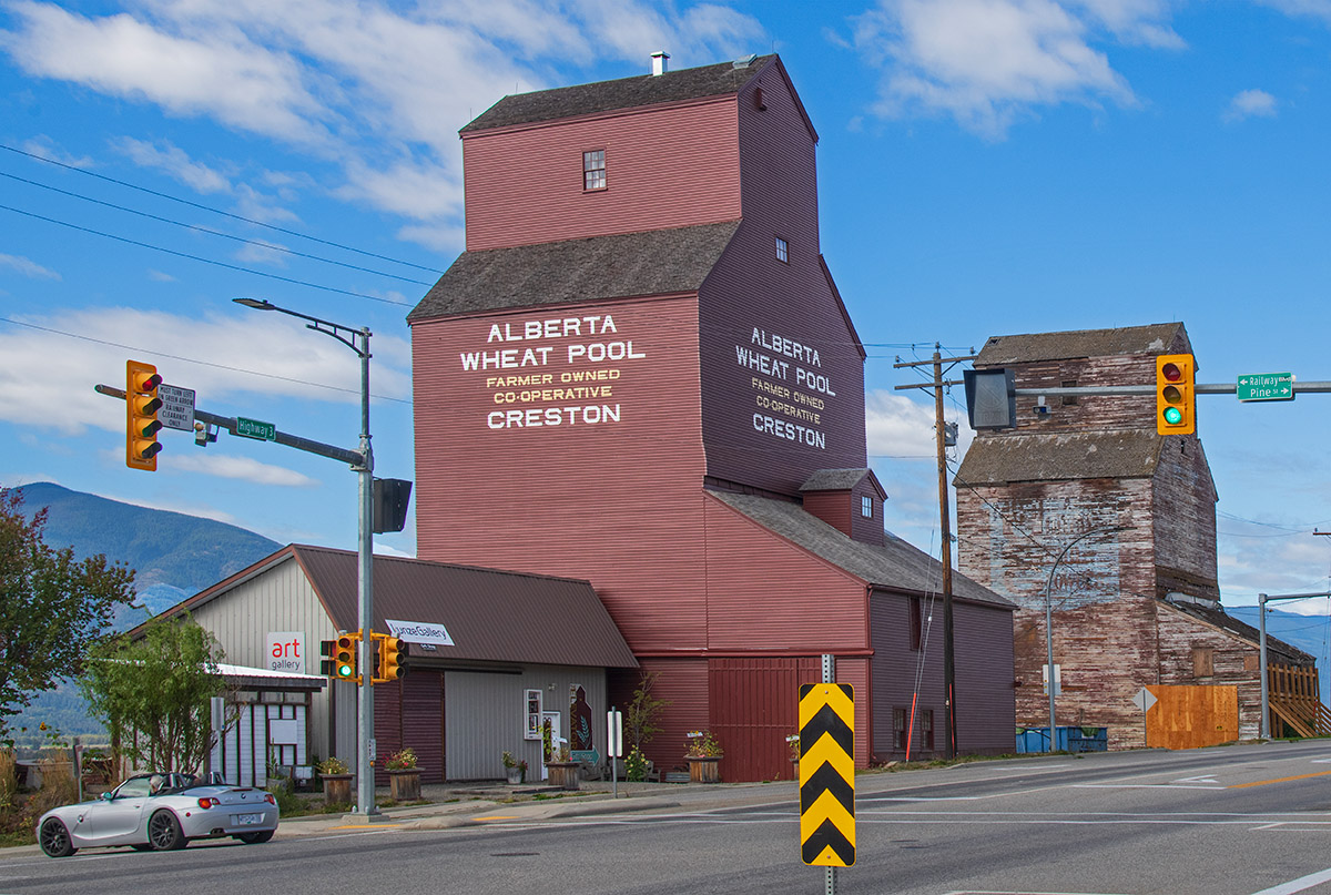
One is an Alberta Wheat Pool elevator with a restored exterior that was recently finished. Plans are in place to begin restoration of the inside. When we visited, another elevator in rough shape stood next to it. We were told that it was slated to be demolished shortly because it had deteriorated too far to save.
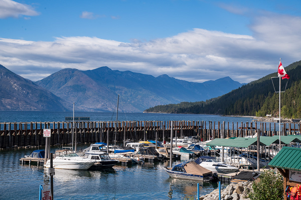
Kootenay Lake
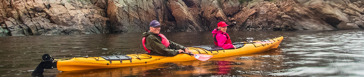
Instead of continuing west on Highway 3, a short but worthwhile detour is to take Highway 3A, which heads north of Creston along the east shore of Kootenay Lake. This was our favourite part of the drive for scenery, along a winding lakeshore road to Crawford Bay.
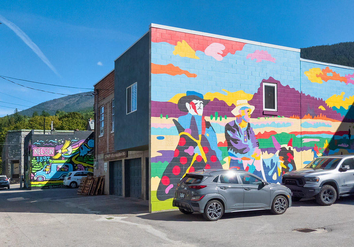
To find out more about the history, music, characters, interesting tidbits and stories about places you come to, you can run the Kootenay Lake Road Trip App developed by Nelson Kootenay Lake Tourism Society. Along with the lakeshore driving tour, there’s also a mural tour in Nelson, and the Kaslo River Trail. Download the Download the free app here.
We spent the night in Crawford Bay at Kokanee Chalets which has comfortable A-frame cabins, as well as a campground. A special feature is the onsite bakery which is especially popular for breakfasts. The lady who checked us into the resort claimed that the cinnamon buns are so good that they are worth fighting a grizzly bear for. Fortunately, no grizzlies showed up during our breakfast.
Getting swept away in Crawford Bay
Crawford Bay is noted as an artists’ town. It has a wide array of arts and crafts but one place in particular intrigued us. North Woven Brooms deals exclusively in handmade brooms. We talked to master broom maker Luke Lewis who gave us a rundown on how he crafts the corn brooms using antique equipment and traditional techniques.
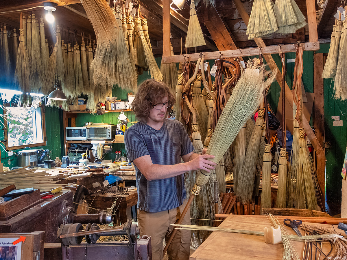
So who would want an antique-style broom we wondered? Some fairly influential people it turns out, the likes of Harry Potter. When the Canadian editions of the Harry Potter books came out, the publisher ordered several hundred brooms to use in promotions.
They also made the broom used in the movie Bewitched, plus several more to promote the movie. The brooms have appeared as props in a variety of other movies, and stage plays such as Cinderella and Fiddler on the Roof. You can buy your own if you want to indulge in a bit of witchcraft or fly around like Harry Potter.
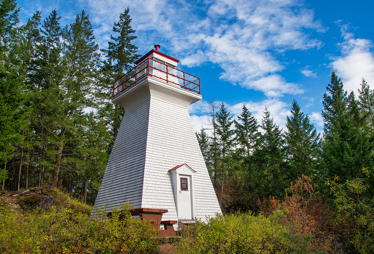
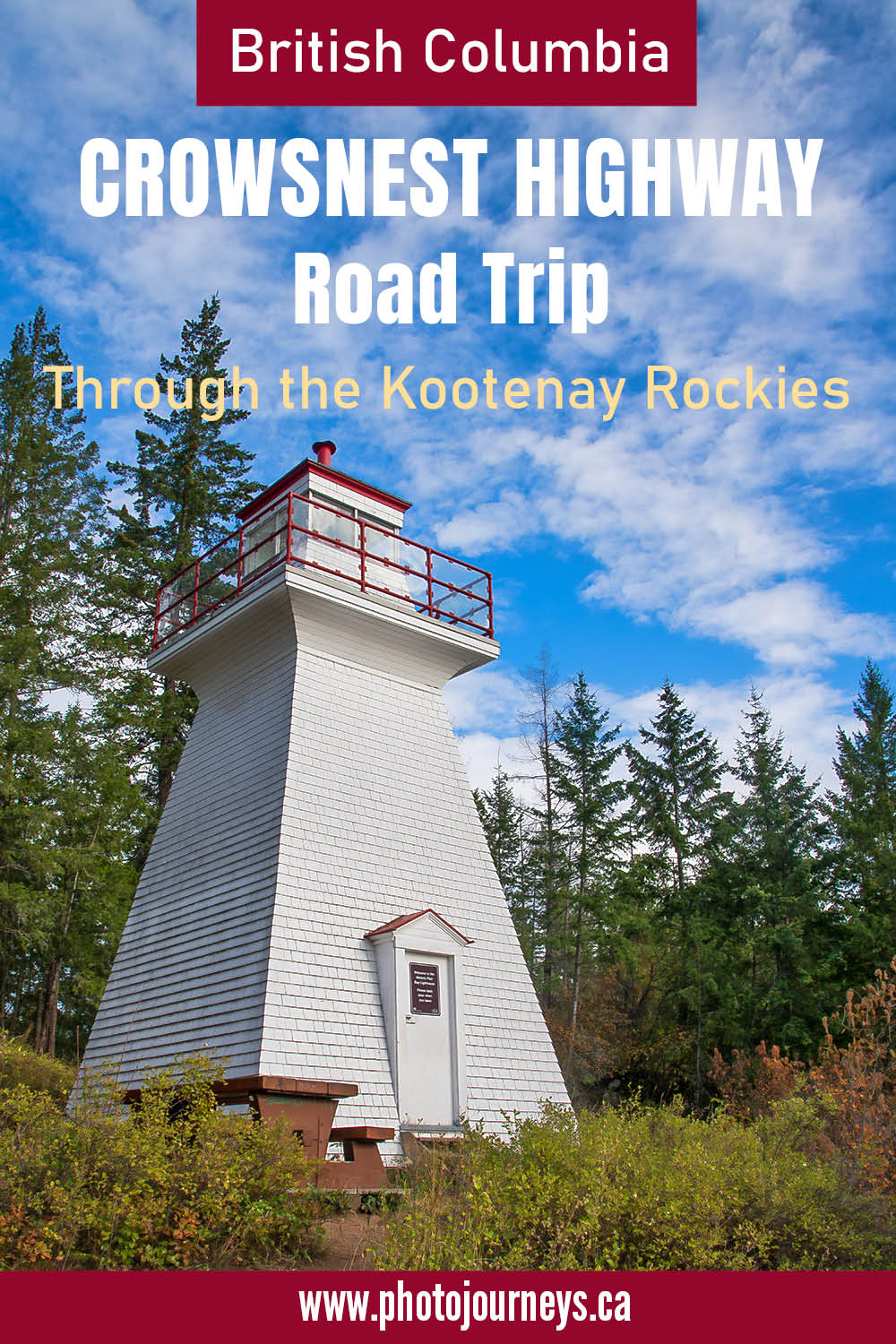
A scene near Crawford Bay that seems to belong on the coast rather than in the interior mountains is the Pilot Bay Lighthouse. Years ago, when sternwheeler boats plied the waters of the long Kootenay Lake, the lighthouse marked the way. To get there, take the short drive from Crawford Bay to the Kootenay Ferry. Just before the ferry, take the road to Pilot Bay Provincial Park. The lighthouse is a short walk from the trailhead.
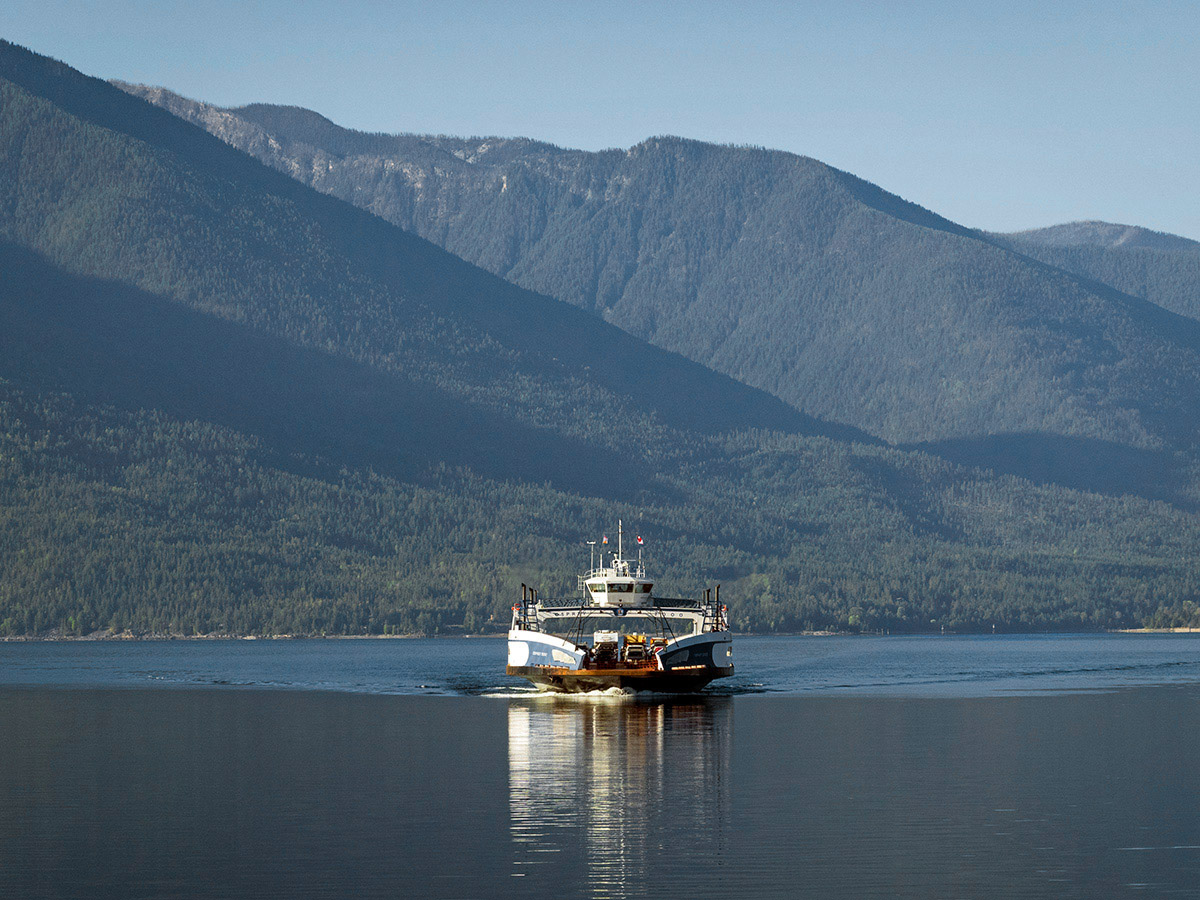
The Kootenay Ferry and Kaslo
From Crawford Bay, we can cross to the west side of Kootenay Lake on the longest free inland ferry service in Canada — a 35-minute trip.
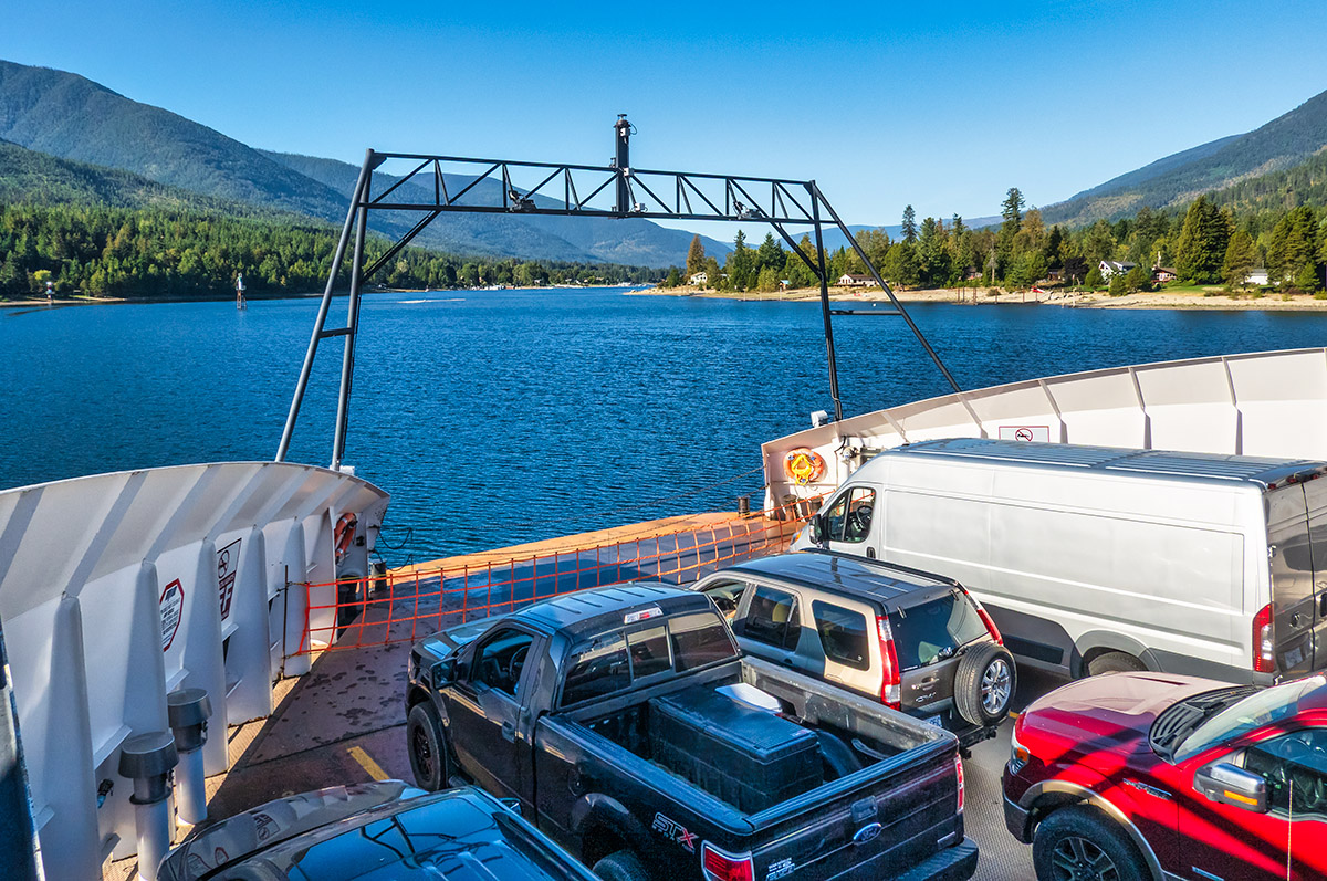
The ferry lands at Balfour. Before continuing west on Highway 3A, it’s worthwhile taking a short 35-kilometre side trip north to Kaslo on Highway 31. Another delightful road, it skirts the west shore of the lake, in places squeezed between cliffs and the lake. We pass the entrance to Ainsworth Hot Springs where you can soak away your woes in naturally sourced hot water. A must-stop along the way is Fletcher Falls, where a short walking trail takes us to viewpoints where Fletcher Creek drops into an impressive waterfall.
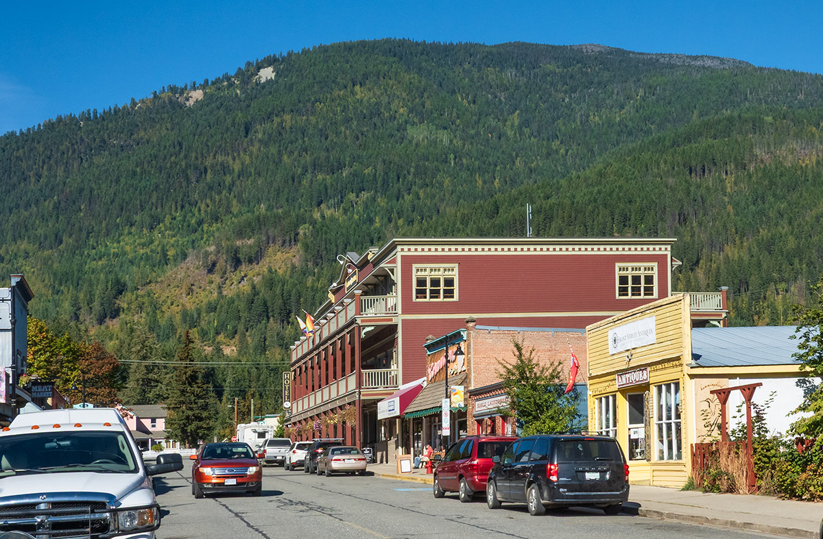
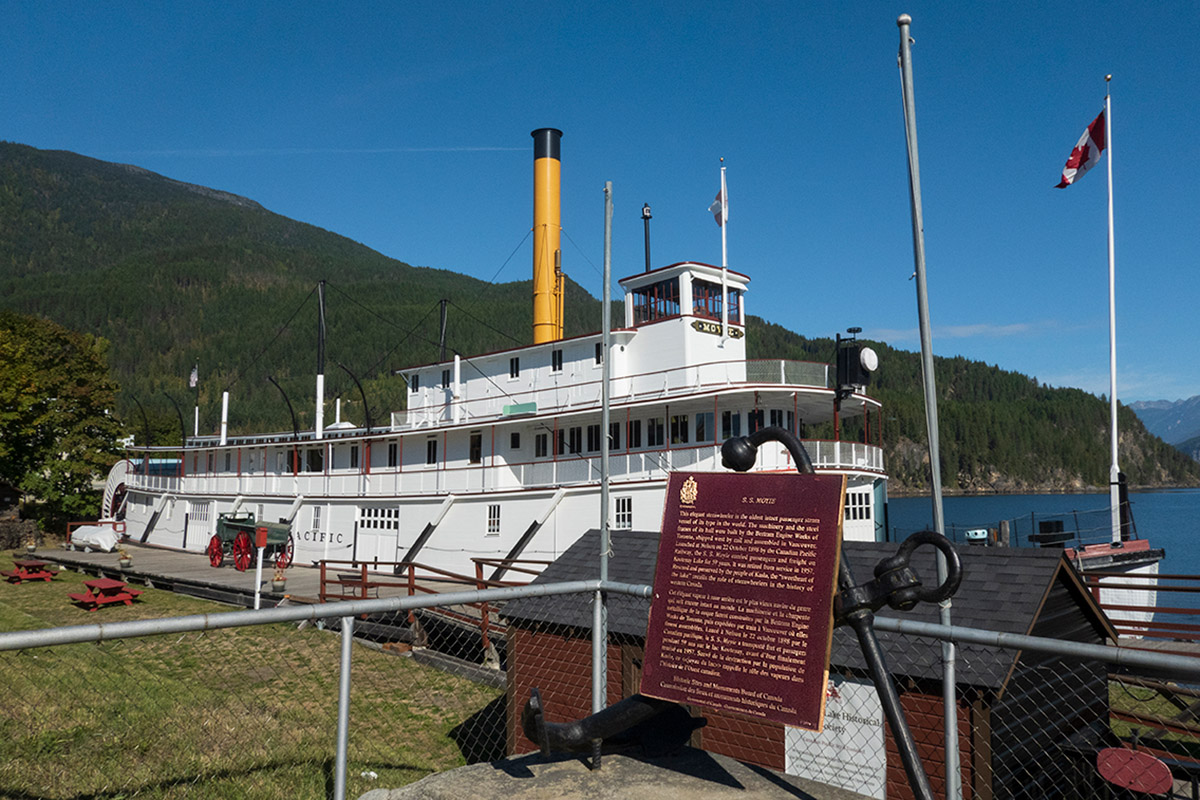
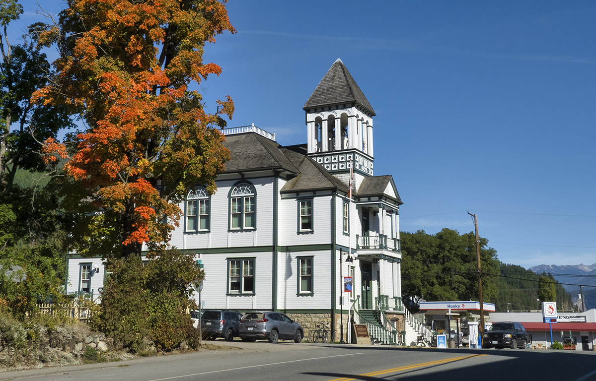
Kaslo is a beautifully situated small town that combines history and nature. It is home to the SS Moyie, an old paddle-wheeler from the early days. Built in 1898, it is the oldest intact passenger sternwheeler in the world. It plied the waters of Kootenay Lake until 1957 and later became a museum and historic site. The town retains several historic buildings such as its distinctive City Hall dating to 1898, the oldest remaining town hall in mainland BC.
To Nelson and Castlegar
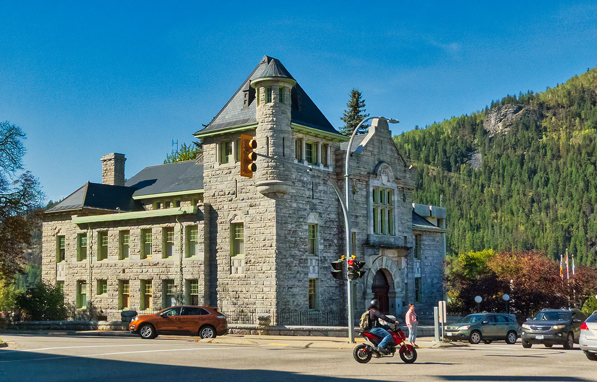
To continue travelling west, return to Balfour and take Highway 3A southwest to Nelson. This small city is surrounded by every mountain recreation possibility you can think of. The centre boasts an impressive number of historic buildings, most of which you can see along a heritage walking tour. Nelson claims to have more restaurants per capita than San Francisco, and they are especially proud that they are almost all local rather than chains.
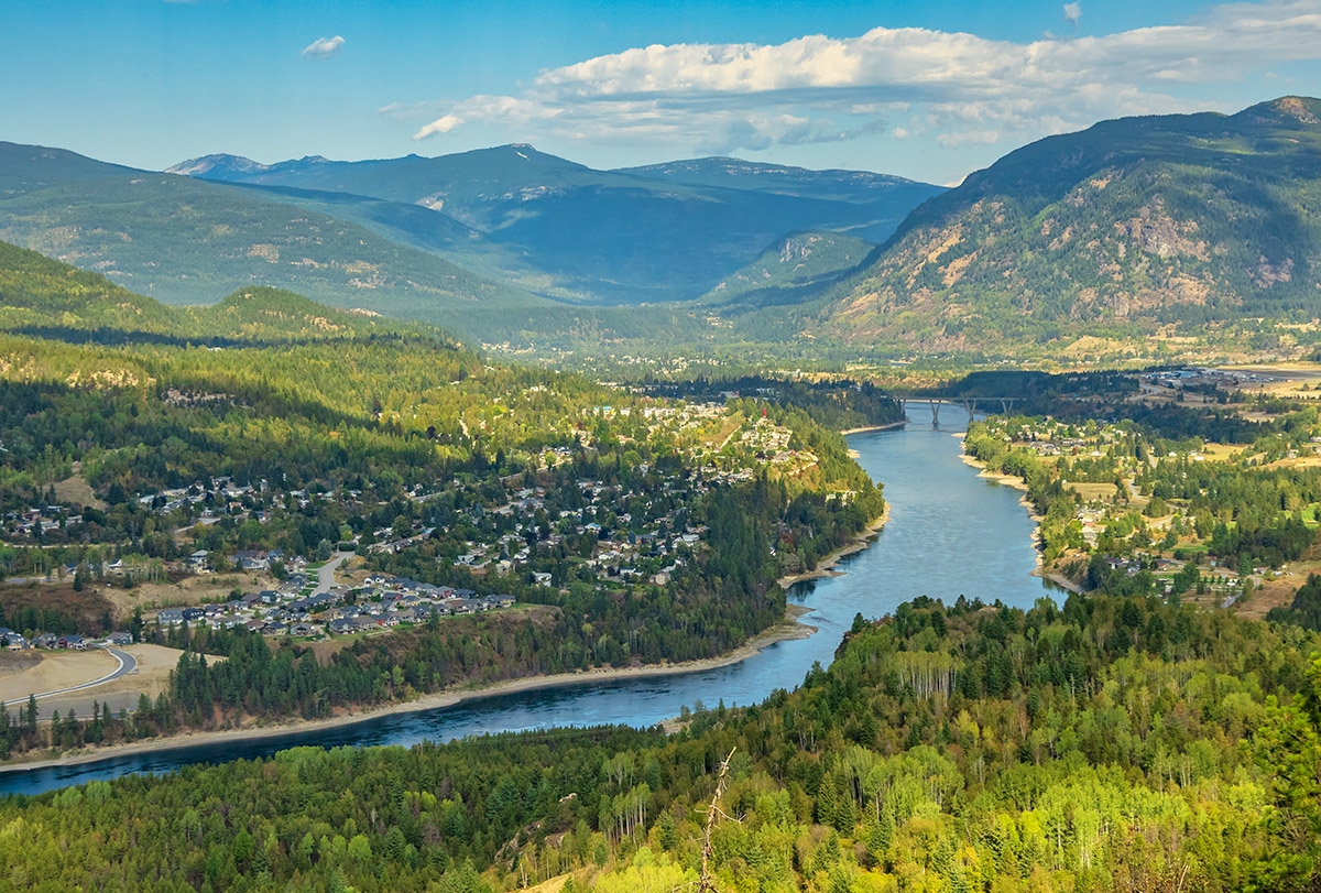
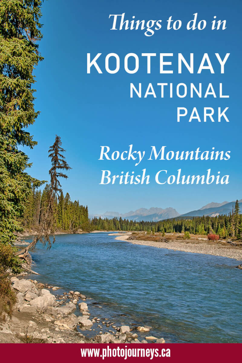
Highway 3A continues southwest along the Kootenay River, with even more panoramic views along the way, ending where it connects to the main Highway 3 at Castlegar. Situated at the confluence of the Kootenay and Columbia Rivers, Castlegar brings together scenery and outdoor recreation with significant cultural and historic attractions.
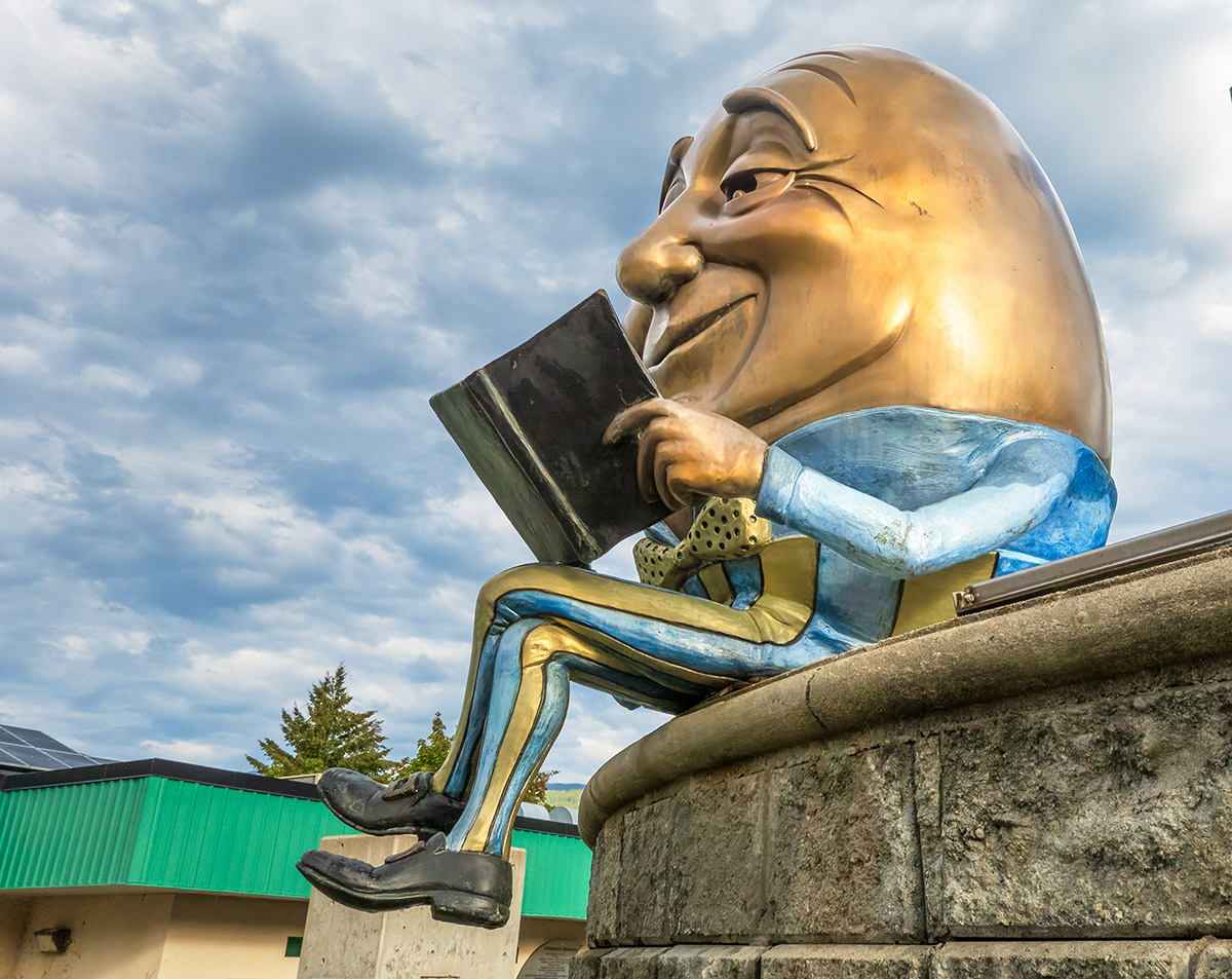
Castlegar has long been an important base for Doukhobor culture. The place to go to learn more is the Doukhobor Discovery Centre with extensive indoor and outdoor displays highlighting the pacifist background, lifestyle, and culture of the people. Castlegar has another claim to fame – it is known as the Sculpture Capital of Canada. Every year a rotating exhibition with several pieces of sculptural art is installed throughout the downtown on a Sculpture Walk. Maps are available describing the location of the artists’ works that include everything from fine art to whimsical, and wildly imaginative pieces.
Final thoughts
These are only a few of the many attractions along the route. To find even more possibilities, see the Kootenay Rockies Tourism site.
Highway 3 doesn’t end here but continues west to meet the Okanagan Valley at Osoyoos, eventually ending near Hope, BC.
More posts on the Kootenay Rockies on Photojourneys that you might enjoy
SUBSCRIBE to Photojourneys below
Feel free to PIN this article on Highway 3 the Crowsnest Highway for later
Great article! Wish we had read 2 years earlier. We took that route home from Vancouver and loved Nelson, but didn’t stop at hardly any of the other places you mentioned. We may have to take that route again with more time and check out all your suggestions. Thanks for all the information we acquire from reading your articles.
Thanks for your comment Amy! This is a route that never disappoints. Hope you have more time available on another trip. Cheers!