All photos © Robin and Arlene Karpan
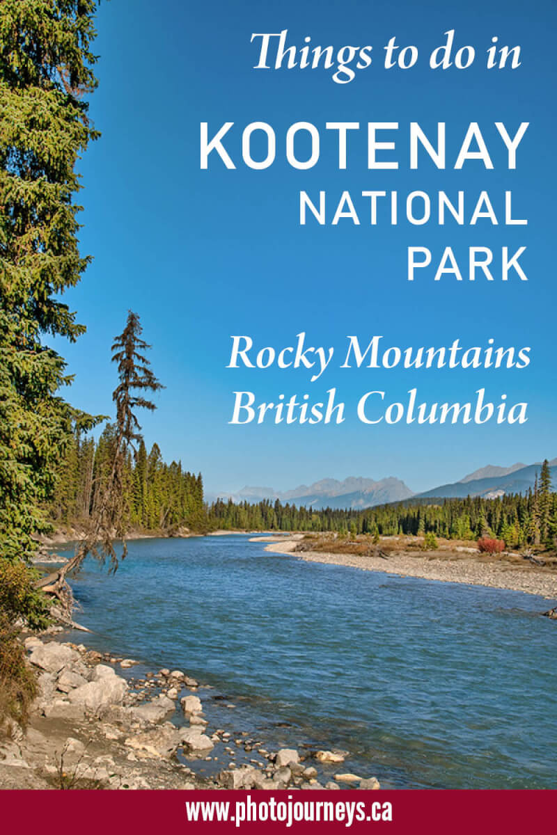
Kootenay National Park is about grand mountain vistas, valleys and canyons, glacial waters, great hiking, and wild colours. It had been a few years since we last visited the park, so this fall we made a return trip to reacquaint ourselves with this wonderful place. Fall, by the way, is our favourite time to go. The summertime crowds are gone, the weather is still nice for the most part, and falls colours add even more pizzazz to the landscape.
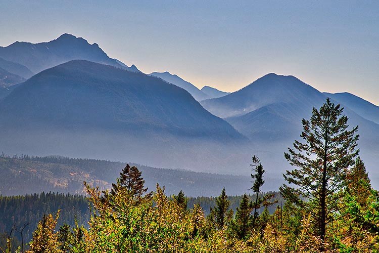
One big advantage of visiting the park is that it’s less busy than its next-door neighbour, Banff National Park, but has scenery that is just as impressive. Indeed, the diverse landscapes are outstanding, from glaciers in the high peaks of the northern part to semi-arid grasslands on the Columbia Valley in the south.
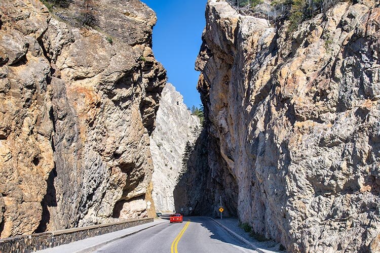
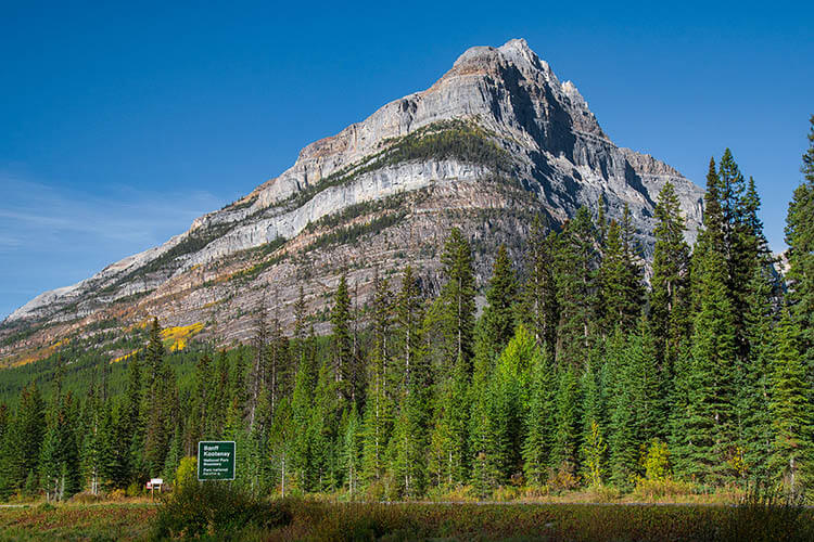
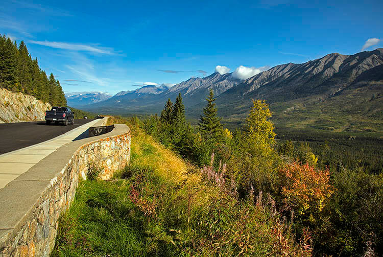
The southern entrance to the park is among the most impressive park entrances anywhere. The highway squeezes through massive rock walls of Sinclair Canyon, and nearby are the brilliant Redwall Fault cliffs. The road continues to twist and turn as it climbs to the Kootenay Valley Viewpoint, one of the park’s most photographed sights.
Highway #93 – Valleys, Mountain Passes, Trails, and River-side Stops
There is one road through the park – Hwy #93, also known as the Banff-Windermere Highway, that runs from the south end near the village of Radium Hot Springs to the north end where it meets the Trans-Canada Highway at Castle Junction, shortly after crossing into Banff National Park. Near the north end, the highway crosses the Continental Divide, separating waters flowing to the Atlantic and Pacific Oceans, as well as forming the border between the two parks and two provinces – Banff in Alberta and Kootenay in British Columbia.
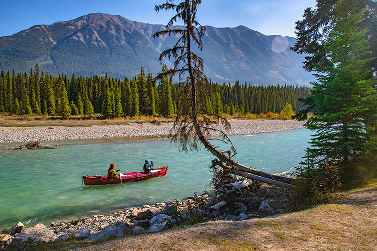
For much of the way the highway follows the Vermilion River, then the Kootenay River farther south, with several turnoffs to trailheads, picnic sites, campgrounds, and scenic viewpoints galore. At the southern end it meets the Columbia Valley at Radium Hot Springs – one of the park’s key attractions.
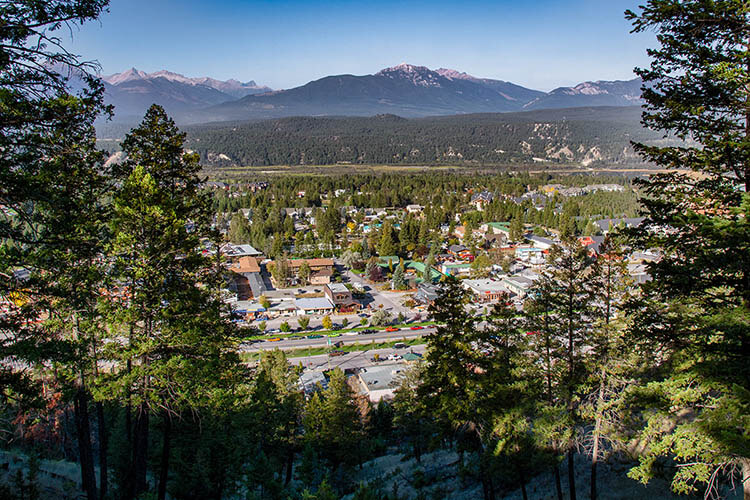
Radium Hot Springs – both a Village and Hot Pools
The name Radium Hot Springs refers to both the hot springs pools which are a short distance inside the park near the south end, and the name of the village just outside the park. According to oral history, the Ktunaxa people of the area used to bathe in the hot water. Things really started to pick up in 1911 when a British medical journal, followed by other medical studies, talked about the curative powers of the radium in the water. Commercial pools developed and later became part of the park. While we find hot springs in various parts of the Rockies, these are in a class by themselves. The setting is breathtaking, tucked into the cliffs of the canyon. Unlike some hot springs which have a strong sulphur smell, here the water is odourless and clear.
Easy Hikes and Walks
The park abounds in awesome hiking possibilities, including several major backcountry treks with various levels of difficulty. If you like to take things a bit easier, some stunning countryside is also accessible on day hikes rated as “Easy”.
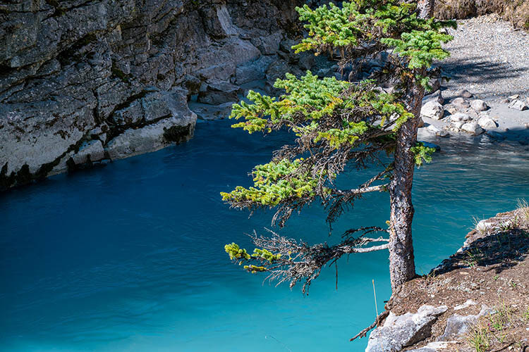
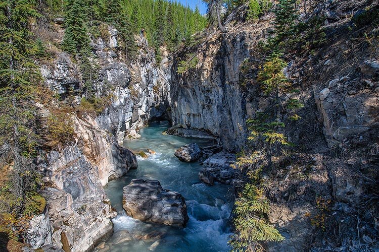
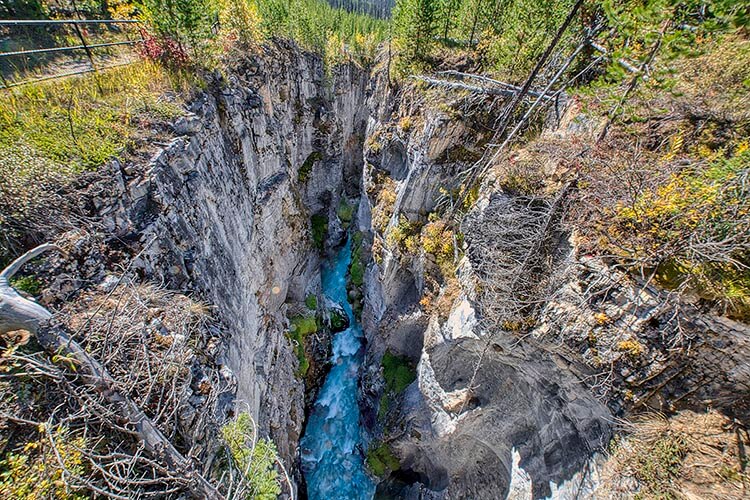
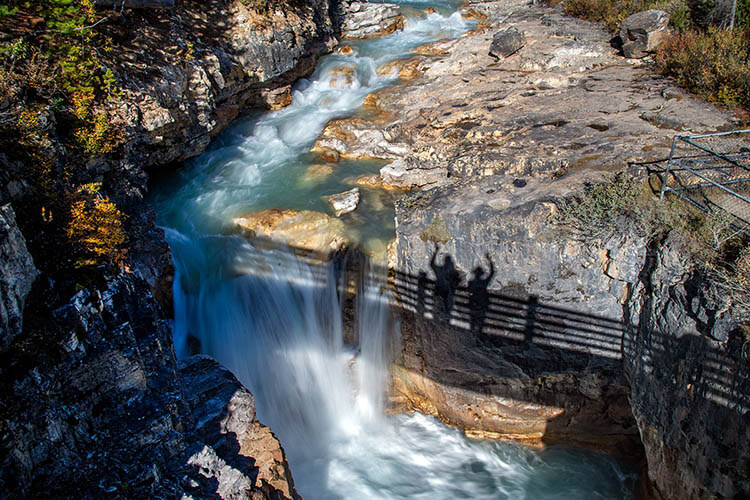
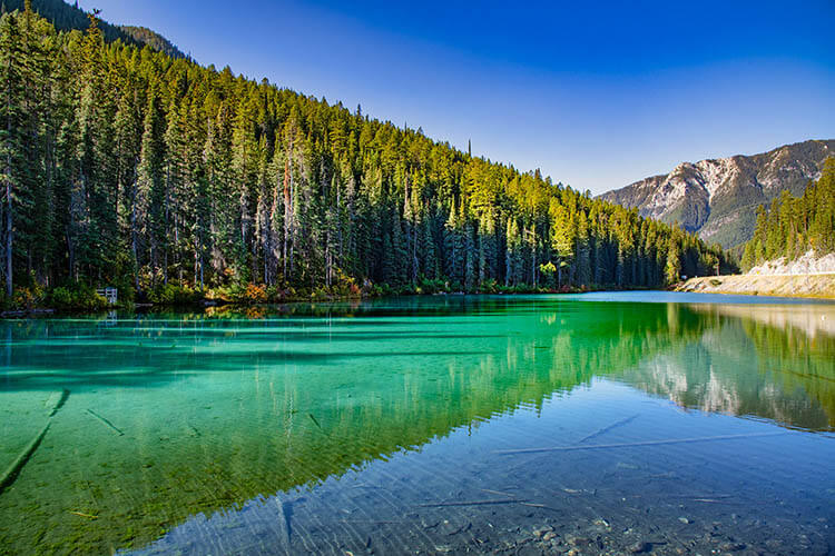
Marble Canyon is one of the park’s top attractions. The walk is less than a kilometre one-way from the parking area beside the highway. The limestone and dolomite gorge has been eroded into some wild shapes, making it a great spot for photography. As we go farther, the canyon gets deeper and deeper, with the turquoise waters of Tokumm Creek disappearing far below. A series of bridges cross the canyon and in many places you can walk along either side. A nice waterfall is at the end of the walk, with the upper reaches of the rushing creek disappearing into the distance.
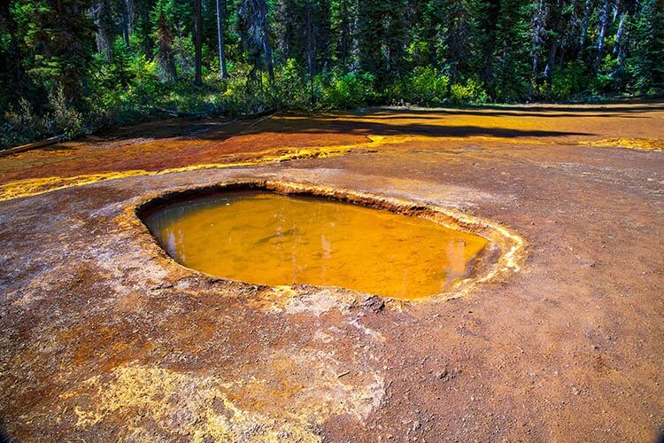
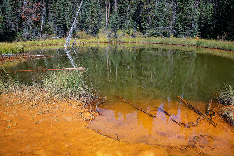
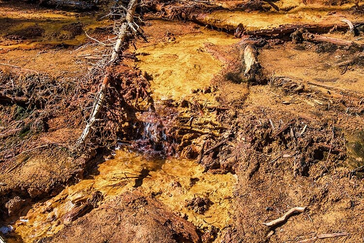
The walk to the Paint Pots is just down the road from Marble Canyon. The one-km trail takes us to some crazy-coloured ochre beds which are mostly orange but also shades of yellow and red. These were used as paint pigment in the days before the park. Come here after a rain or step too close crossing the shallow puddles and you’re guaranteed to walk away with colourful shoes.
You can combine the two above walks by taking the Marble Canyon to Paint Pots Trail. Park at the parking lot for either one then take the 2.9 km trail linking the two. Much of the way the trail passes right beside the Vermilion River as well as going through part of mature and burned forest.
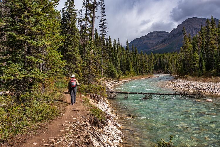
The Dog Lake Trail starts at the McLeod Meadows picnic area, 28 km north of Radium Hot Springs. You can do the 5.2 km walk by going to Dog Lake then returning the same way or make a longer circle route by combining it with other trails. There’s only a 40-metre change in elevation. Here too, the small lake was especially scenic because of the fall colours. Another highlight is near the beginning of the trail where you cross two bridges spanning the unreal blue waters of the Kootenay River. The shallow edges are favoured spots for fly fishermen. If you don’t want to do the entire trail, it’s definitely worthwhile coming at least this far.
The Cobb Lake Trail is a pleasant 5.4 km return walk that starts just west of the Kootenay Valley Viewpoint. The forest trail descends to Swede Creek then goes slightly up and ends at tiny Cobb Lake. This is a gorgeous spot, looking its best during fall colour season. The walk has an altitude change of 190 metres, mostly near the beginning as you descend to the creek by a series of switchbacks.
The Valleyview Trail is short, only about 1.3 km one way, but the views are non-stop. The trailhead is on the road that runs from Radium Hot Springs village to Redstreak Campground – the park’s main campground. From here the walk follows the hilltops overlooking the village, with sweeping views over the broad Columbia Valley. It makes for a short convenient walk if you’re staying in the campground. If you want more of a workout, another branch of the trail runs uphill from the visitor centre in the village to the rim of the valley.
Another short hiking option, mostly through the forest, is from the campground to the hot springs, about 4.6 km return. These link to several other paths in the area, including the Juniper-Sinclair Canyon Trail which has a more ambitious elevation gain of 350 metres.
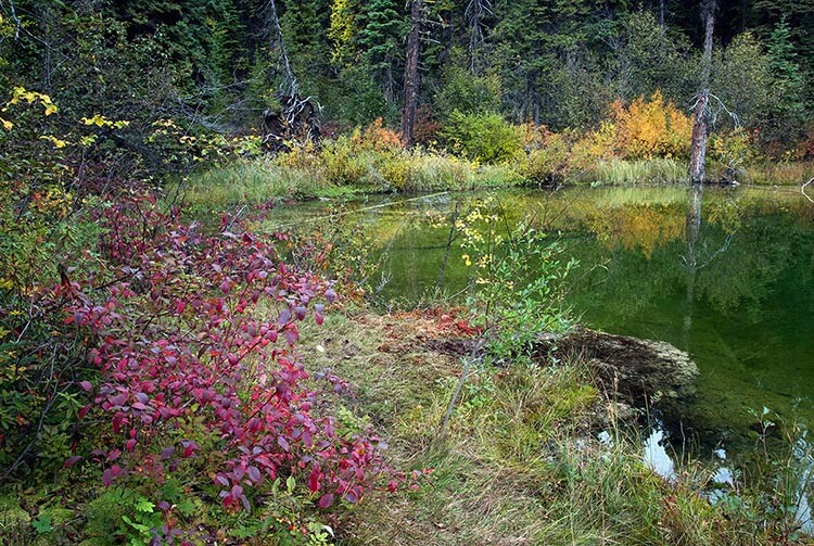
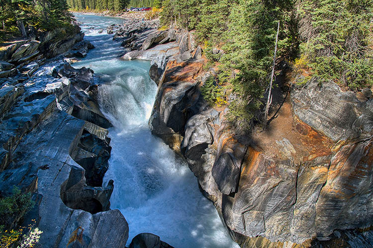
Some stops are not really hikes since they are very close to the highway. One is Numa Falls, a gorgeous spot where the Vermilion River drops and rushes through a canyon next to the highway. Another is Olive Lake which is between Sinclair Canyon and the Kootenay Valley Viewpoint. As the name suggests, the lake has a bright olive green colour. A short interpretive walk takes us to two viewpoints on either side of the small lake.
Looking for wildlife
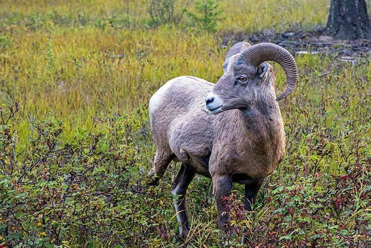
The park’s larger wildlife ranges from grizzly and black bears to moose, elk, white-tailed and mule deer, mountain goats, and bighorn sheep. What you might see is often a matter of chance. However, we usually don’t have to go far afield to find bighorn sheep. They seem to like hanging out close to the village and the hot springs area. We saw them almost every time that we drove between the village and Redstreak Campground.
Where to stay
Those not camping usually stay in the village of Radium Hot Springs which has a variety of accommodation. The main park campground is Redstreak, just up the hill from the village. It’s in a beautiful location with campsites that are more spacious than we find in many parks.
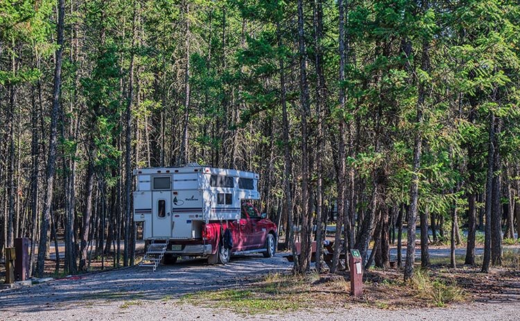
There are three other frontcountry campgrounds along Highway 93, at Marble Canyon, McLeod Meadows, and Crook’s Meadow Group Campground. When we visited in September, those were already closed for the season, with Redstreak being the only option.
Resources
- A handy guide to driving through the park is the Kootenay Guided Tour App. The GPS-triggered app not only alerts you and provides details to points of interest along the way, but also includes behind-the-scenes stories by Parks Canada staff who work there. Be sure to download it onto your mobile device before venturing out on the highway, since there is no cell service in the park other than close to Radium Hot Springs.
- For details on other hikes and attractions, see the Parks Canada website for Kootenay National Park.
- For a more comprehensive look at the many other attractions of the region, see Kootenay Rockies.
- Also see 10Adventures for other useful tips on the park.
SUBSCRIBE to Photojourneys below
Feel free to PIN this article on Kootenay National Park for later