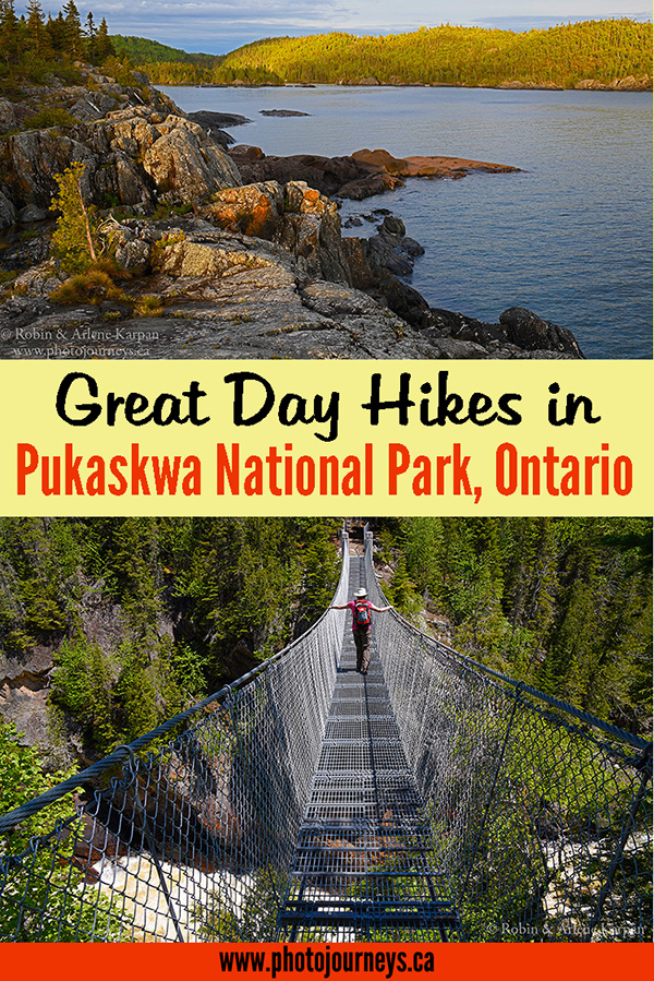

What we liked best about Ontario’s Pukaskwa National Park is that it offers outstanding remote wilderness but is easily accessible. Tucked away along the northeast shore of Lake Superior, it lies roughly halfway between Thunder Bay and Sault Ste. Marie, and only 15 km off the Trans Canada Highway. The one and only road to the park is just east of the town of Marathon. After you arrive at the Hattie’s Cove campground and day use area, you may as well put your car keys away for the rest of your stay – the only way to get around now is by either walking or paddling.
The first thing to learn, preferably before you arrive at the park, is how to say Pukaskwa. Despite what its spelling might suggest, it’s pronounced “Puk-a-saw”. The exact origin and meaning of the word have been lost in time. Thought to have Ojibway origins, one interpretation is that it referred to cooking animal bone marrow. No doubt about it, Pukaskwa Park has a better ring than Marrow Cooking Park.
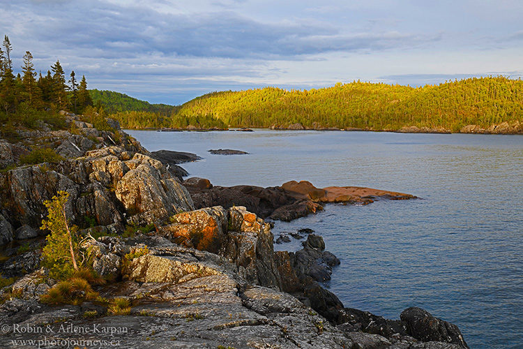
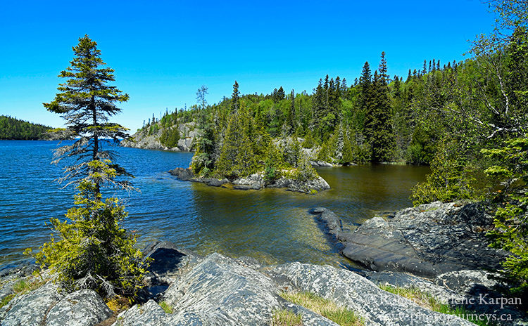
With 135 km of rugged coastline, the park is a mix of ancient granite bedrock, rocky headlands, mixed forest with both boreal and southern tree species, golden sand beaches, and stunning views at every turn. The Coastal Paddling Route provides great opportunities for canoeing or kayaking, while the 60-km Coastal Hiking Trail ranks among Canada’s premier backpacking routes. Don’t worry about missing out if you’re not prepared for multi-day wilderness expeditions. We found a wealth of amazing landscapes accessible on day hikes from Hattie’s Cove.
Hattie’s Cove
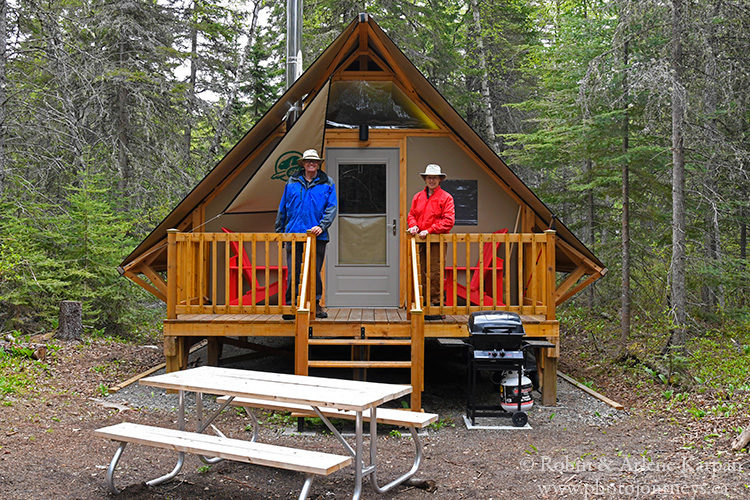
The campground at Hattie’s Cove is the only place to stay in the park, other than at remote wilderness campsites. If you don’t have camping gear, oTENTiks (a cross between a frame tent and small cabin) offer an excellent option.
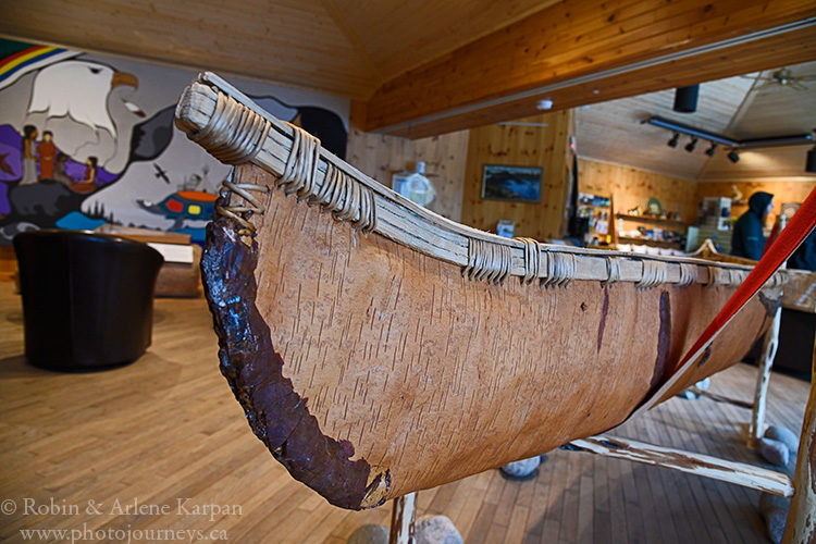
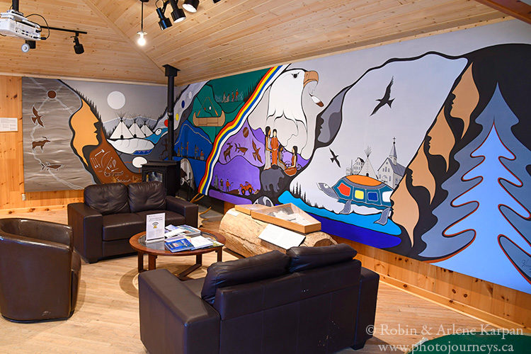
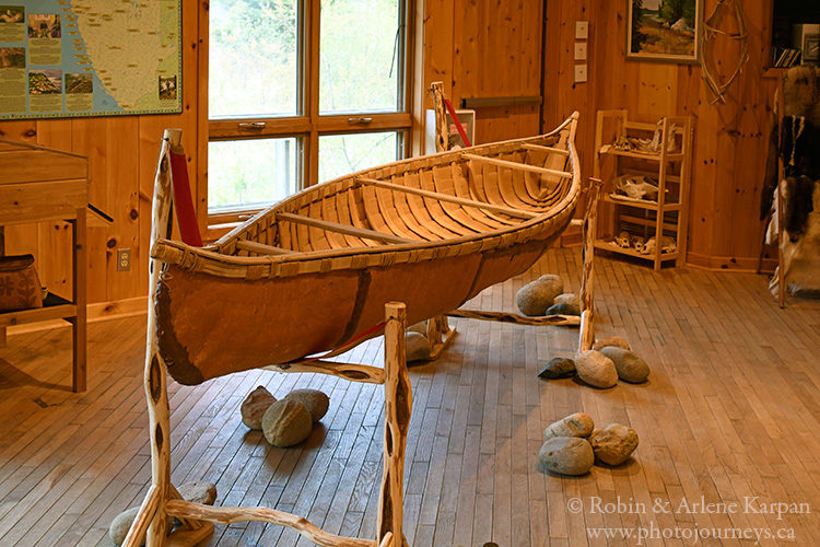
The visitor centre is one of the most inviting we’ve come across anywhere, with souvenirs, and a comfortable sitting area to while away time on a rainy day or use the free WiFi. Attractive murals with traditional designs and an authentic birchbark canoe add to the setting. The views out the front window ain’t so bad either.
Interpreters relate stories and practices of the local Anishinaabe people at a nearby cultural camp. Other than that, you won’t find shops or fast food joints prevalent in many other parks. The emphasis is very much on enjoying the solitude of the natural setting.
Day Hikes
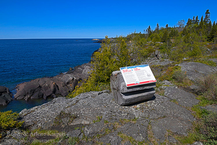
This is where the park really shines, with a network of relatively short trails that you can combine into longer walks. Along the way, interpretive panels describe the geology, plants, wildlife, and history of the area.
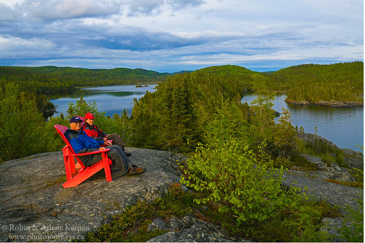
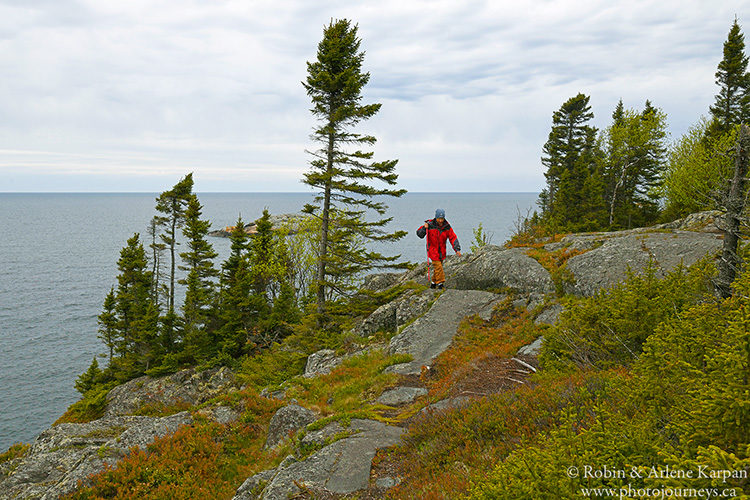
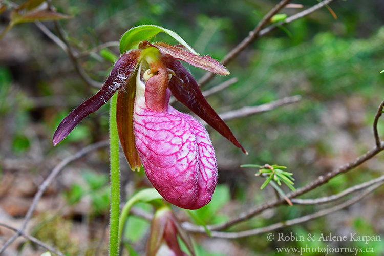
Our favourite is the 2.2 km Southern Headland Trail. Rated as Moderate, it starts near the visitor centre then almost immediately climbs the rocky hills overlooking Hattie Cove. At the top we find a pair of Parks Canada’s famous Red Chairs, the perfect rest spot to enjoy some gorgeous views. It then winds along the top of the headlands as we look over the vastness of Lake Superior to the south. Rock formations, wildflowers and other plants add to the photo possibilities. The trail ends at the attractive sandy beach in Horseshoe Bay, close to the campground. It’s easy to see how the beauty of Lake Superior has inspired many artists, such as the Group of Seven.
While the Southern Headland Trail is wonderful throughout day, the prime time for photography is early morning or just before sunset when low light illuminates the hills and beach. Since the trail is so close to the campground, and the light kept changing, we ended up walking it several times.
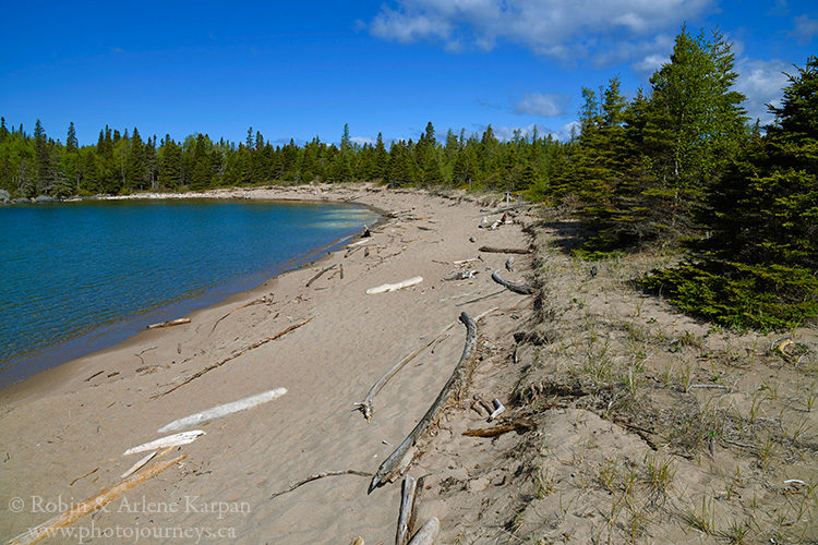
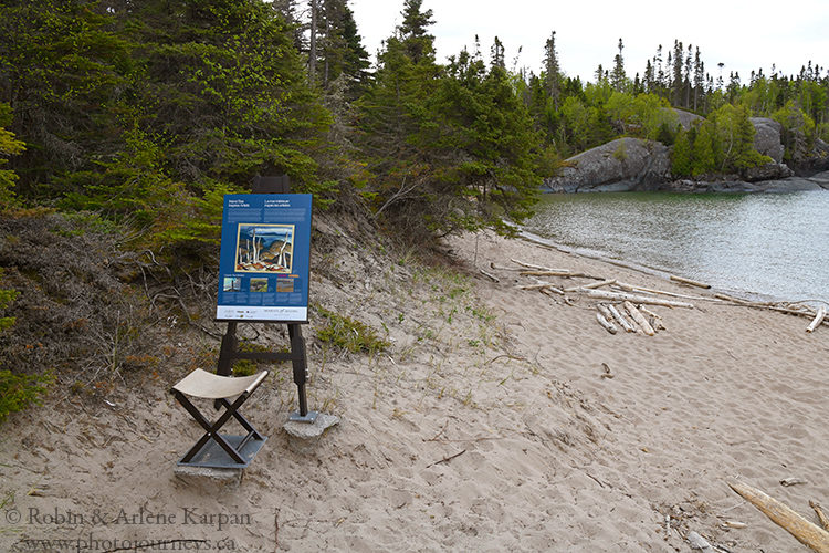
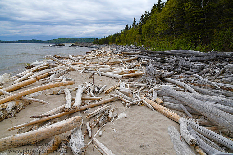
In Horseshoe Bay, the Southern Headland Trail meets the 1.2 km Boardwalk Beach Trail. Rated as Easy, it follows a raised boardwalk that crosses fragile dune formations. As it continues, the name changes to the Beach Trail (rated as Moderate), a 2-km walk that crosses a narrow peninsula before coming out on Middle Beach and North Beach. Driftwood litters the sandy beaches – not just the odd log here and there, but huge accumulations requiring a bit of fancy footwork to pick your way through in places.
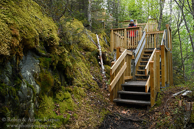
The peninsula that the Beach Trail crosses is also the trailhead for the Manito Miikana Trail (or “Spirit Trail”). On this gorgeous walk, stairways take us over rocky ravines on the way to the top of the headlands. Then it’s grand vistas galore, almost like walking through a Group of Seven painting.
The only walk without views of Lake Superior is the Bimose Kinoomagewnan Trail (or “The Walk of Teachings”). Rated as Moderate, the mostly forested 3.7-km trail circles Halfway Lake, and relates stories and teachings of Anishinaabe elders.
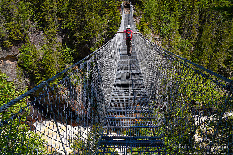
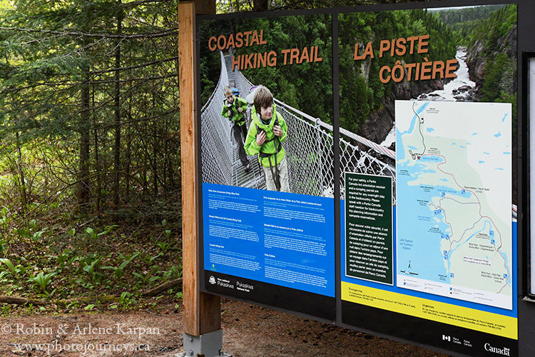
White River Suspension Bridge Trail
This full day hike stands in a class by itself. The 18-km return hike is the first part of the Coastal Trail, and takes you to one of the park’s most dramatic features. Rated as Difficult, we didn’t find it technically difficult; however, a lot of uneven surfaces and climbing over roots and rocks added to the challenge. The altitude gain is only 15 metres, but the constant ups and downs mean that you likely gain and lose that 15 metres several times. Avid photographers should allow at least the 8-9 hours as the park suggests, and perhaps a bit more.
The trail starts along the edge of Hattie Cove through an area burned in 2012 and now regenerating. We cross some wetlands on boardwalk, then stay in the forest most of the way. This first section is the most rugged part of the walk. After about 4.5 km we come to Lake Superior’s Playter Harbour, a beautiful spot and also site of a backcountry campground. It’s an obvious place for a lunch break. On a sunny, early summer day, we just needed a short-sleeve shirt while walking the forest. But closer to Lake Superior, even in this relatively protected bay, the air suddenly cools. Donning sweaters, we’re reminded how this massive lake creates its own climate.
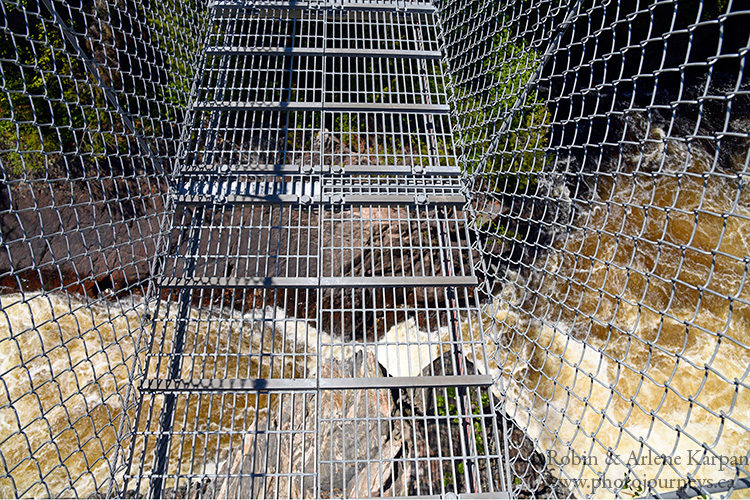
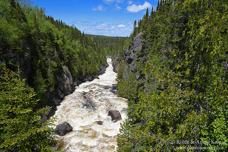
We hear the White River long before we see it. Then suddenly we emerge from the trees at the suspension bridge. Stepping onto it, we cautiously glance down 23 metres to frothing Chigamiwinigum Falls. We look through open steel mesh along the floor of the 30-metre long bridge, so at first it’s quite disconcerting and dizzying peering straight down to the wild water far below.
As far as we can see in both directions, the White River roars and cascades down the deep gorge. We spend a lot of time here photographing and just drinking in the magnificent scene. The long walk has been more than worth the effort. But it’s not over yet. We have to do the same hike all over again to get back to camp.
For more details contact Parks Canada.
SUBSCRIBE to Photojourneys (below) to receive our latest posts
Feel free to PIN this article