
Our pilot Cliff gives us a final wave as he taxies his Single Otter float plane near the lake’s sandy shore. Turning the plane to open water, he guns the throttle. The powerful engine roars to life, the propeller sending spray across the water surface and pontoons leaving a wake as the plane picks up speed. Seconds later the Otter lifts off and soon disappears down the lake. This is the real start of a wilderness adventure – when the pilot leaves and we’re completely on our own.
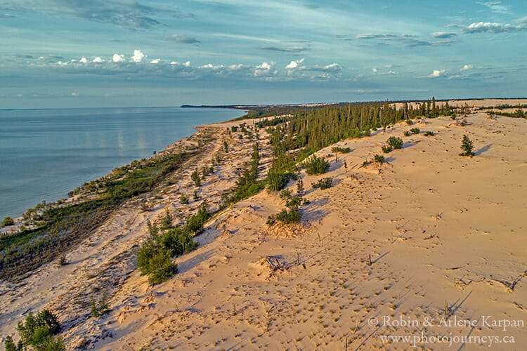
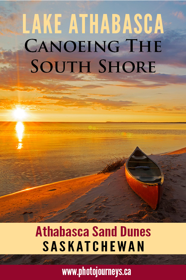
We’re on the south shore of Lake Athabasca in Saskatchewan’s far north with a canoe loaded with camping gear and food to last us more than a week. The fourth largest lake completely within the borders of Canada, Athabasca is impressive not only for its size but how it straddles two vastly different landscapes. The north shore is classic Canadian Shield country with rocky outcroppings, rugged cliff faces, deep bays, and islands galore. The south shore is low-lying and sandy, with almost non-stop beach lining its shallow waters.
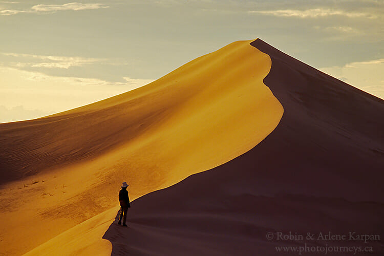
Our plan is to explore the Athabasca Sand Dunes, the largest dunes in Canada by a long shot, and the largest this far north anywhere in the world. Scientists tell us that the dunes originated with the retreat of glaciers and subsequent wind and wave action on ancient river beds. Local Dene tell the legend of a giant beaver that used to live in these parts. A hunter threw a spear at the beaver which, in the throes of death, thrashed its tail to such an extent that it ground the earth into sand.
Stretching for 100 kilometres along the lake, the dunes have been preserved in a provincial park that is purposely kept wild with no roads, no buildings, no people, no cell service, and no infrastructure of any kind. Just pristine wilderness. Our kind of place.
Up the Creek
Most of the world’s great dunes are in deserts or at least arid regions. But here, they’re smack in the middle of boreal forest, next to a massive lake, and sliced by three rivers. The best part is that we can explore the dunes by canoe. How cool is that!
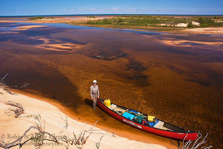
We start our journey near the sprawling delta of the William River, the westernmost river running through the dunes. We had travelled here before and were able to paddle partway upstream on this shallow, sandbar-laden river to get further into the dunes. However, this approach is only feasible with enough water flow.
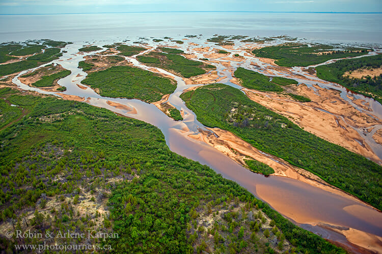
This part of the lake is so shallow that it’s possible to stand up a half kilometre or more from shore. As we work our way into the delta itself, there’s barely a trickle of water washing over the sandy deposits. We soon bottom out and get out of the canoe to guide it to a deeper channel. This doesn’t concern us at first. It’s not unusual for the river to dump a bunch of sand at the delta. Ever the optimists, we tell ourselves that the water should get deeper as we travel further into the river and away from the expansive delta.
The next kilometre or so proves to be a constant struggle. Every few metres we have to jump out of the canoe and guide it, and sometimes drag it, to find enough water to stay afloat. It’s becoming apparent that it’s not just the delta that’s clogged with sand, but the river itself. Water levels on the William depend on a fairly small watershed. If there’s not much rain or snow, the river will be low. It looks as if this is one of those years. Time for Plan B.
Canoeing Lake Athabasca’s South Shore
Our revised plan is to paddle along the lakeshore, an enticing prospect though a bit worrying. It will give us access to the various dune fields along the way, but we’ll be exposed to Athabasca’s whims. The south shore is wide open, with no islands or deep bays for protection. Prevailing winds from the northwest often batter the south shore big time.
A landmark in Thomson Bay is a large rusting tank, swept ashore years ago when a transport barge carrying goods between Lake Athabasca communities broke up in a ferocious storm. We have also experienced Athabasca’s fury first-hand on previous trips. One time we were storm-stayed in the same spot for five days, unable to move because of the relentless waves.
When we arrive back at the delta, we find the lake uncharacteristically calm, almost glass-like. The land of the giant beaver can be fickle indeed, stopping us from heading upriver then inviting us onto its great lake. We leave the delta and head into Thomson Bay that extends 25 kilometres in a broad horseshoe sweep with the prominent hill at Beaver Point at the far end.
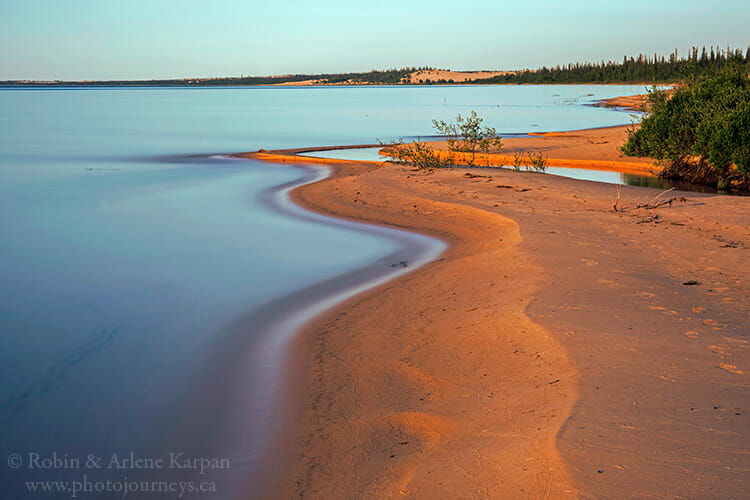
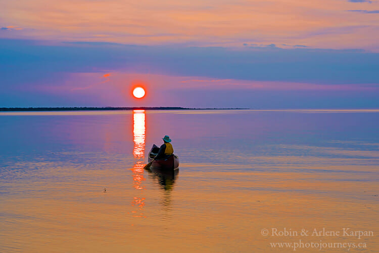
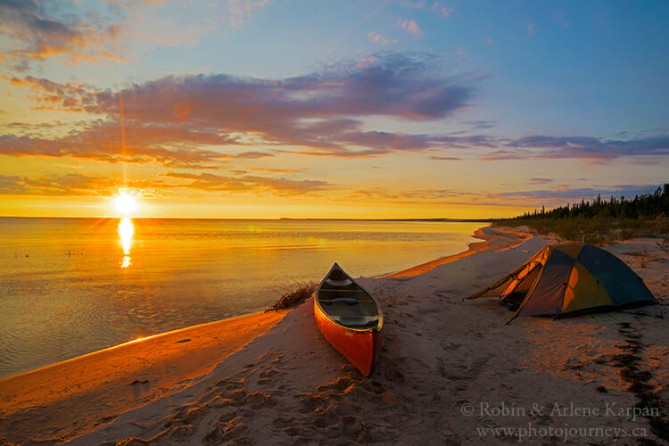
Early evening, we make camp on a gorgeous stretch of beach. With calm conditions and the weather looking stable, we set up the tent almost next to the shoreline, instead of looking for a sheltered spot as we normally would. Sunset doesn’t come until 10:45, so we have time for a relaxing supper before setting our chairs on the water’s edge to watch the sun slowly melt into the lake against an apricot sky.
Mid-summer nights can be short for photography fanatics since sunrise comes around 4:30 am. The next morning is nothing short of magical as the sun clears the lake and washes a lemon and tangerine glow across the quiet landscape.
Making Tracks
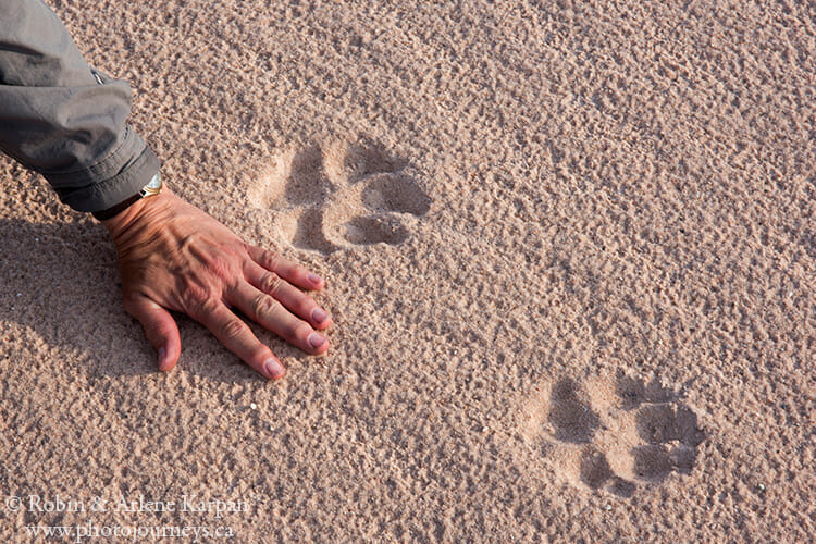
We keep moving down the shoreline. With so much sand, it’s easy to identify critters that have been wandering around, and there are lots of them – bear, moose, wolves, various birds, frogs, and a hodge-podge of bugs. On a canoe trip, we usually avoid camping where we see signs of bear, but now that proves impossible. Bear tracks are simply everywhere.
One morning we wake up to constant splashing sounds from building waves. The next place we want to go is only a little more than an hour away, so we decide to press on in case conditions worsen later in the day and we aren’t able to travel. Cautiously, we guide the canoe into deeper water past the pounding surf on shore. Fortunately, the wind is in our favour, helping to keep us on course while negotiating the rolling waves. Our route is lined with continuous beach so we can quickly land in case things get dicey. The wind and waves strengthen but we arrive without incident, other than a bit of a soaking while landing the canoe in crashing waves.
Rare Plants and Ghostly Skeletons
We head to a bush back of the beach to find some shelter to set up camp. Behind the scattered spruce and birch trees lie huge sand dunes, their leading edge slowly burying this remnant of forest.
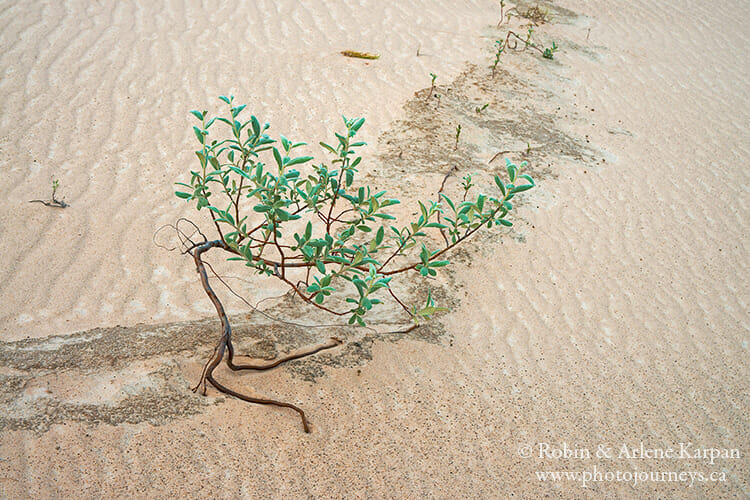
The hummocky ridges between the forest and beach prove great places to find rare plants. The unusually high number of rarities is a prime reason these dunes were preserved in a provincial park. Many species are endemic, found nowhere else on earth. The felt-leaved willow is the most plentiful, its soft leaves covered with thick woolly hairs, giving it the look and feel of felt. Then there is sand chickweed, with tiny delicate flowers that grow out of pure sand. The most unusual is the Athabasca thrift, its round red cluster of flowers atop a thin stem looking like miniature candy apples stuck in the sand.
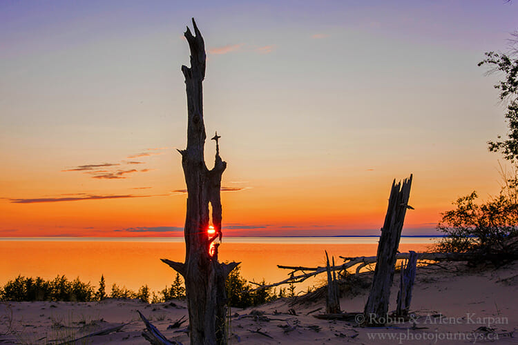
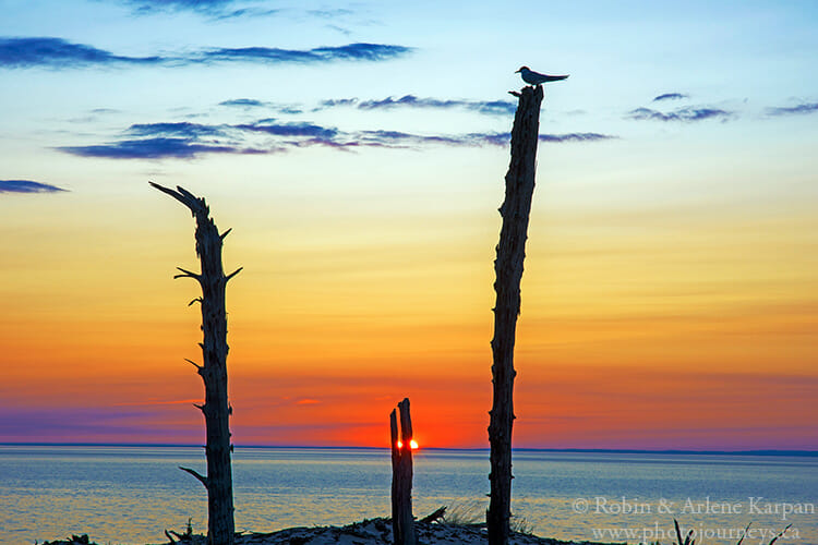
The highlight for us, and the main reason we wanted to stop here, is the exhumed forest. Along the slope of the highest dunes stand remnants of an ancient forest, desiccated tree trunks and roots that are at least hundreds of years old. In the distant past, this forest was buried by advancing sand, then over the years as the dunes migrated eastward with the prevailing winds, they were exhumed from their sandy grave.
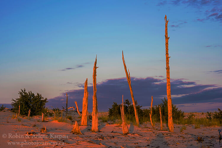
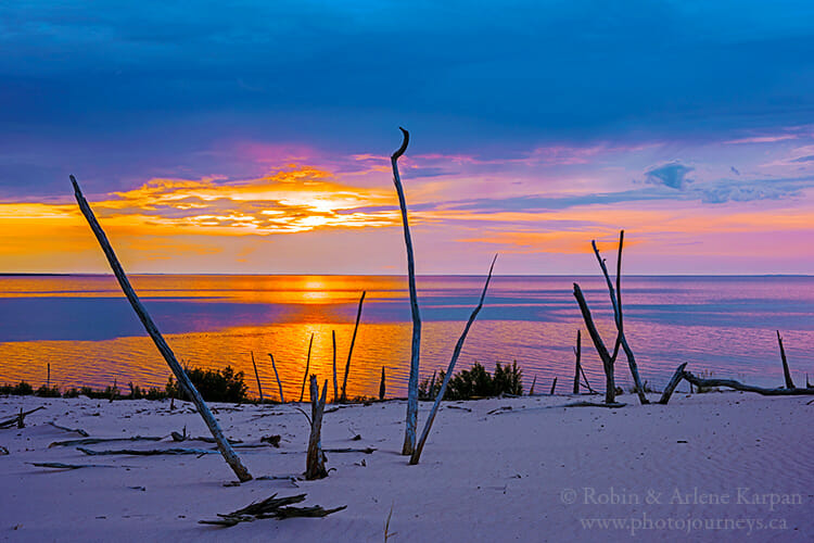
Each evening we witness the transformation of these skeletal sentinels. Just before the sun dips into Lake Athabasca, it shines up at the ghostly whitish-grey trees and bathes them in a blood-red glow. Stepping back for a wider view, we photograph them silhouetted against the fiery sky. Never did the forest look the same as the night before, and never did we tire of its magic.
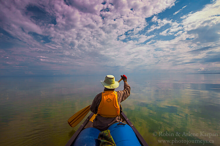
Along the next stretch of our journey, we have to round Beaver Point, with a long sandy spit stretching far into the lake. We are aware of how tricky it will be to deal with waves slamming us broadside if the winds persist. But the morning we plan to leave, the waves are not only gone, but the lake surface is like a gigantic mirror. Wispy clouds reflect in the vast expanse of water, with little distinction as to where the sky ends and the lake begins. We’re thrilled with the calm conditions, though it’s a surreal feeling, as if we’re paddling into the Twilight Zone.
Archibald River
To our great surprise, the lake’s gentle mood holds for the next two days as we travel through Cantara Bay, stopping to explore dunes along the way. Eventually, we reach the mouth of the Archibald River. The smallest of the three rivers that cut through the dunes, the Archibald is like a narrow ribbon dividing two vastly different worlds. The east bank is mostly jack pine, spruce, and birch forest typical of the area, while the west bank is lined with towering dunes, some over 30 metres high.
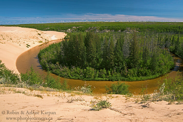
The river is too shallow even for a canoe, though we can walk a long way upstream by following the crests of the dunes bordering the river. In places, the tiny river almost becomes lost between forest and sand. Prevailing winds keep pouring sand into the river, forcing it to gradually change its course over time.
We camp on a sand ridge just back of the beach, a delightful spot with widely-spaced trees resembling a planned park. Like everywhere we’ve stopped, an array of animal tracks crosses the sand. After our first night, we noticed fresh bear tracks not far from the tent. A couple of days later, the same thing – more bear tracks. It looks as if the bears were just passing through, and fortunately they weren’t curious enough to hang around.
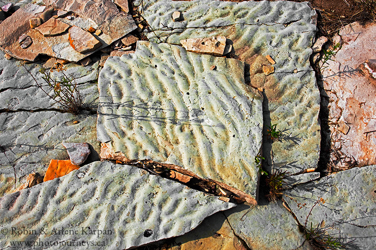
For most of our journey, rocks have been few and far between in this sandy environment. But near the Archibald, part of the shoreline is strewn with thin, flat slabs like paving stones that lie scattered among broken smaller pieces. Many have distinctive ripple patterns. When we later show these photos to geologists, we learn that these ancient sandstone remnants were formed by the action of wind and water over a billion years ago.
We scout an idyllic spot for sunset, on top of a sand dune overlooking the shoreline and river mouth. It hosts a smaller version of an exhumed forest like the one in Thomson Bay, though some of the ancient tree trunks are eroded so intricately that they appear more like carved works of art.
We often see Arctic terns that like to nest on the edge of the dunes. Each evening one tern returns to roost on a specific dead tree, arriving almost like clockwork just before sunset. It seems to have claimed this tree and isn’t about to change its routine just because a couple of interlopers have shown up. This bird has likely had little, if any, experience with people.
Come to think of it, neither have we recently. Since getting dropped off over a week ago, we haven’t seen another person or even another boat. We can’t help but think what a rare privilege it is to not only experience such a spectacular landscape, but also to have it all to ourselves.
Calm Before the Storm
The calm weather over the past few days seemed almost too good to be true. Based on our experience, this lake makes you pay dearly if you get too complacent. We check weather reports via satellite on our InReach device, and it looks as if things are about to change dramatically.
Since it is close to when we planned to end the trip, we contact our pilot Cliff to see when we can arrange a pick-up. He replies that he’ll be there tomorrow, adding that it will be a fairly short window to get us out before the storm hits. Forget about landing a float plane here in bad weather.
The next morning we hear the distinctive and welcome roar of the Otter as it swoops overhead then sets down in the lake nearby. Cliff lets the plane drift close to shore, so we wade out in the refreshingly frigid water to load the gear and tie the canoe to one of the pontoons.
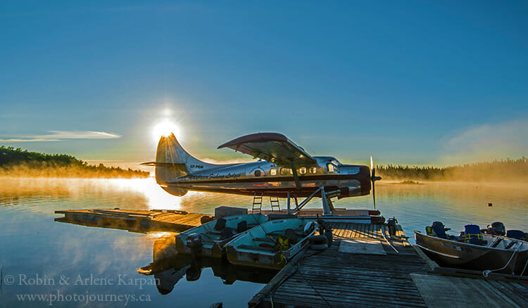
Less than an hour’s flight later, we arrive at Athabasca Fishing Lodges. That evening brings intense rainstorms and fierce winds. Tempestuous waves the next day force even the lodge’s substantial fishing boats to stay put. The land of the giant beaver can mesmerize us with spell-binding wonders that we find nowhere else, but it never fails to remind us that we only travel here on its terms.
SUBSCRIBE to Photojourneys below
Feel free to PIN this article on Exploring the Athabasca Sand Dunes
Have you ever traveled the north side
Yes, we have travelled the north shore of Lake Athabasca which is very different from the south shore, with a lot of deep bays, islands, rocky cliffs and outcroppings. We used a motorboat there. You could canoe it, but because of the many bays it is more difficult to stay close to shore.
I love the views and I hope you don’t mind that I used some information on the south shore and Archibald river for a Biology field study I had to do for school. I will cite it appropriately.
Thanks for letting us know, Martin. We are pleased that you found useful information. Good luck on your report.