If you like Saskatchewan scenic drives that are well off the beaten path, consider this trip in the Souris River Valley in the province’s southeast. While there is a lot to explore in the area, one of our favourite routes is the road between Roche Percee and Hwy 19, winding along the river almost the entire way. This road definitely has a remote feel to it, with few farm yards and little traffic. The road is mostly gravel in good condition, although there are a few spots where wet weather could make travel unadvisable.
Roche Percee
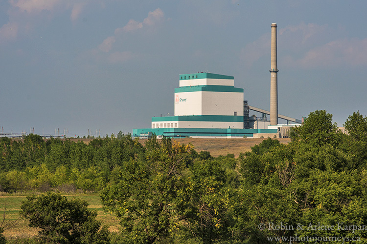
The hamlet of Roche Percee is about 20 km southeast of Estevan. Our favourite route to get there is to take Hwy 18 east of Estevan, then turn south onto Shand Road just outside the city. The approach to the Shand Power Station is about 8 km along. From the parking area at Shand Observation Point, you can enjoy views to the south along the Souris River Valley. The greenhouse uses heat from the station to produce thousands of tree seedlings annually.
Return to the road and keep going south across the Souris River. At the T-intersection, turn left (east) and follow this road to Roche Percee, passing beside Short Creek for part of the way. At the corner where the grid road meets the pavement, a cairn commemorates Short Creek Camp where the North West Mounted Police camped on their historic March West in 1874.
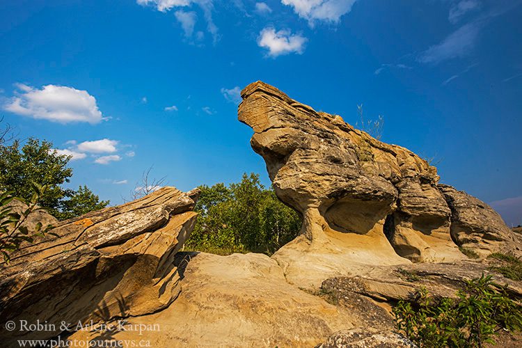
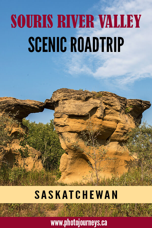
Turn east on the pavement and continue less than 1 km to the impressive Roche Percee sandstone formation, for which the community was named. The hilltop outcrop once supported a window-like hole, hence the French name “roche percée”, meaning “pierced rock.” However, the upper portion has long since collapsed.
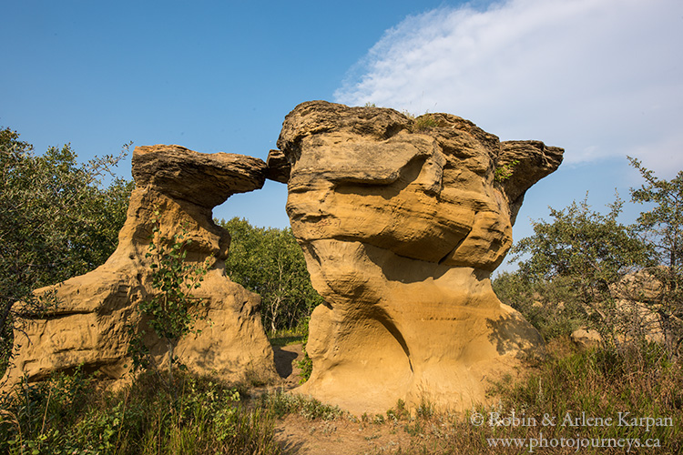
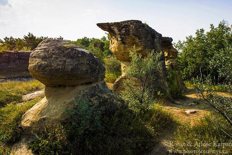
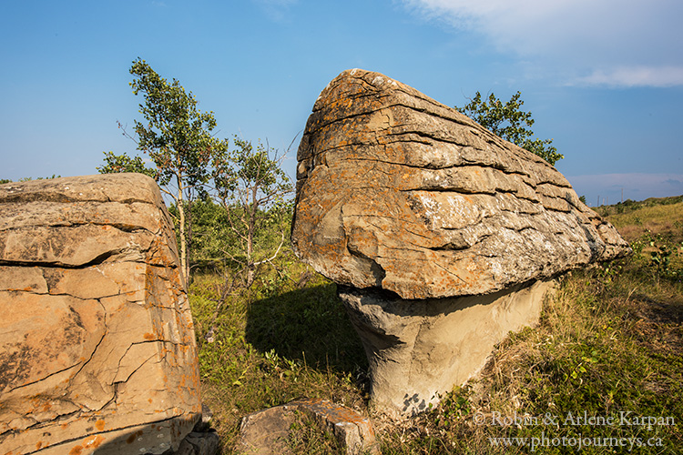
Over the years, the rock served as a prominent landmark to First Nations peoples, then to Mounted Police, surveyors, rumrunners, and settlers. Look closely and you will find names carved into the soft rock dating back well over 100 years. While the main formation beside the road is the most obvious, the sandstone covers a large area. Be sure to explore farther back and into the wooded areas to find other strange formations.
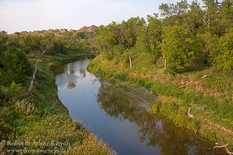
From the Y-intersection at the rock formations, take the gravel road that heads east and soon crosses Hwy 39. Almost immediately after crossing the highway, watch for the turn-off on the north side to the Roche Percee Campgound, a basic but attractive campground near the meandering curves of the Souris River.
The Eastern Souris River Valley
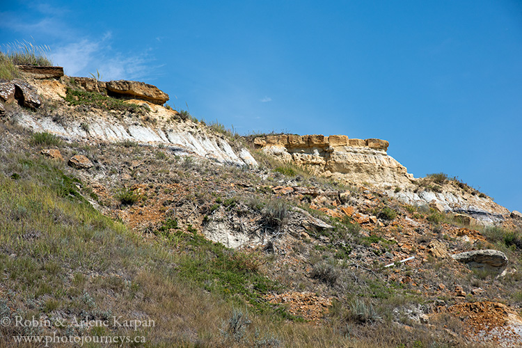
Travelling east, you pass through an especially scenic section of the valley with sandstone formations on both sides. Less than a km past the campground entrance, a sign indicates “Heritage Cemetery” to the north. It’s worth the short detour for the views over the valley. The road crosses the river then winds around a hill known as Sugarloaf because of its distinctive shape. Just beyond a sign indicates the entrance to the historic Taylorton Cemetery, the only reminder of the former community of Taylorton, established in the 1890s.
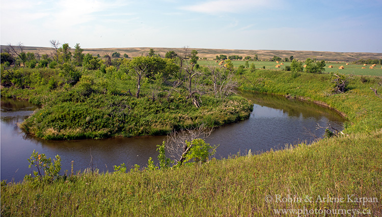
Back on the main road, the road soon curves north then crosses the Souris River to the north. For a short distance, the road leads away from the river to a pretty side valley with grass-covered hills. Along this section, the road becomes narrower and rougher, but should be in reasonably good condition during dry weather, especially if it’s been recently graded. Then it leads back to the Souris, where forage and field crops grow on the fertile plains. Watch for birds such as northern harriers, red-tailed hawks, mourning doves, and perhaps a turkey vulture soaring effortlessly overhead.


Eventually you come to a stop sign at Grid Road 604 that leads to North Portal in the south. Cross it and continue east. In this last 17-km section, the valley character changes from the sandstone cliffs near Roche Percee to lower rolling hills as the valley widens. About 6 km past the grid road crossing, you reach a Y-intersection, where the main branch heads left (north) out of the valley. To stay in the valley, take the right fork. For a few kilometres, the road becomes more of a narrow trail with less gravel, but it improves and widens farther on. The valley drive ends at Hwy 9, southwest of Oxbow.
For more detailed information on this and other drives in the region, complete with maps and GPS coordinates, see our guidebook Saskatchewan’s Best Scenic Drives.
SUBSCRIBE to Photojourneys below
Feel free to PIN this article
Hello is it possible to get a printed copy of Souris River Valley
Scenic Road Trip?
mY MOTHER’S family grew up in this area. Love the scenery..In fact my grandfather,mom’s dad, had a picnic area along the Souris when living in either Waldheim or Carnduff. Love your photos. I am a prairie girl and love your photos.
Thanks for your comments Marlene.
There was the old picnic spot outside of Carnduff that is on my land and was used by the Archery club for a few decades. But my grandmother said that others would use it as it was a long stretch of sandy beach alongside the river.
Unfortunately it’s the source of a lot of vandalism and ditch parties now. Most things that showed the old picnic spot were long destroyed by the time I grew up
i WONDER THIS COULD BE THE AREA MY GRANDFATHER, jACOB C. SAWATZKY TALKED ABOUT HAVING A PICNIC ON THE SLOPES OF THE RIVER BANK.