All photos ©Robin and Arlene Karpan
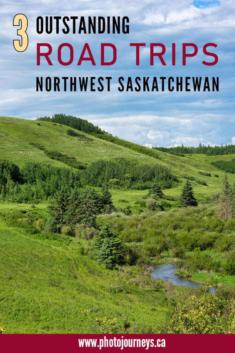
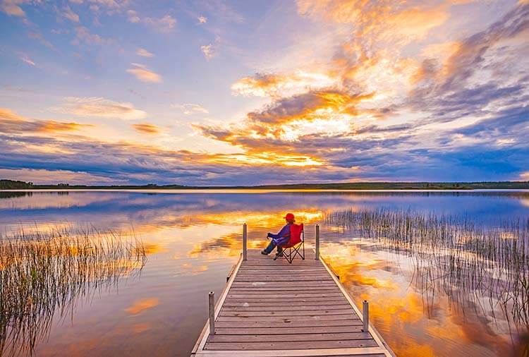
Saskatchewan’s northwest abounds with wonderful scenic drives. Here are three of our favourite road trips which you can drive individually or link together into a grand tour of the region. We explore the boreal forest, lakelands, river valleys, the northern reaches of the grain belt, provincial parks, nature reserves, and beautifully-situated small communities. History looms large, including the last military battle fought on Canadian soil.
Road Tripping through Meadow Lake Provincial Park
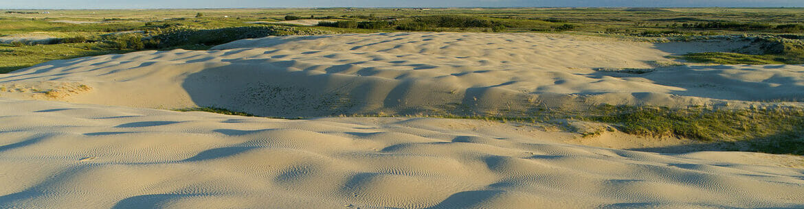
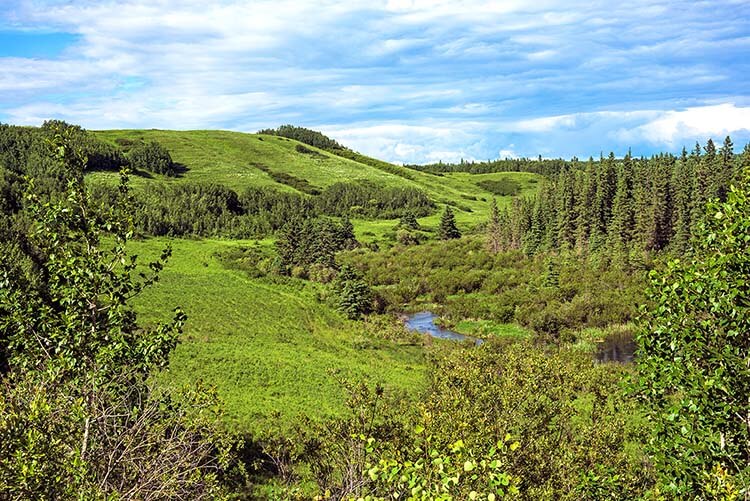
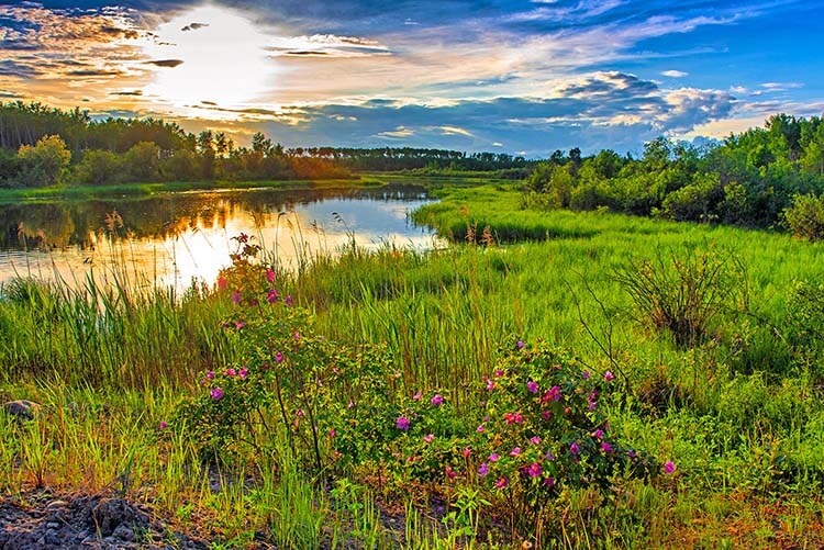
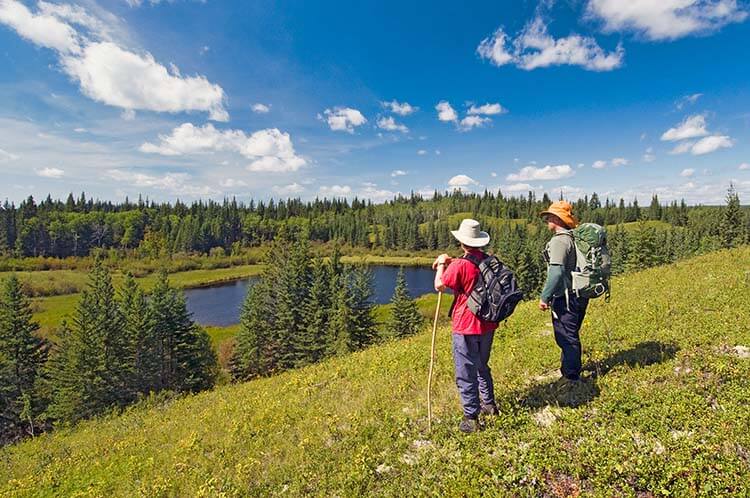
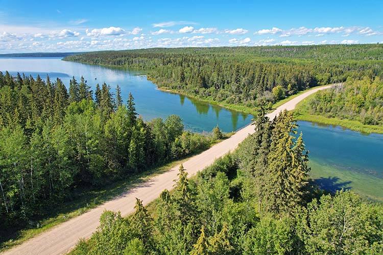
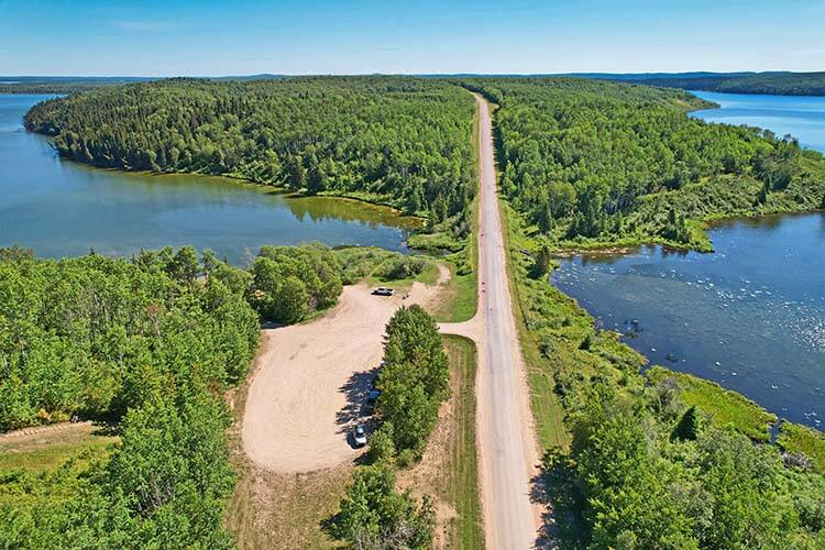
Meadow Lake Provincial Park is among the largest parks in the province, encompassing more than 1,600 square kilometres of mixed wood forest, over 20 lakes, along with rivers, streams, marshes, and meadows. Water-based activities are particularly popular, as are numerous hiking trails sprinkled throughout the park. Roads run the length of the long narrow park, providing access to the many lakes, rivers, campsites, and trails.
For this route we will concentrate on Hwys #224 and #950 that together run east–west through much of the park, beginning north of Meadow Lake and ending north of Pierceland. Count on driving around 150 km one-way, including side trips into a few lakes and campgrounds.
The park’s undoubted highlight is the 135-km Boreal Trail, the first long-distance wilderness trail in the Saskatchewan provincial park system that is both easily accessible and has facilities designed specifically with hikers in mind. The trail stretches most of the way across this large park, from Cold Lake near the Alberta border to Greig Lake in the east, taking you through fascinating forested lakelands, wetlands, up and down hills, and along the Waterhen River.
If 135 km sounds a bit much, don’t worry. Several points have road access and marked trailheads, so you can hike as much or as little as you like. The Boreal Trail also links up with many shorter walks in the park.
Meadow Lake is the largest community in the area and the main jumping-off point for the park. Head west along Hwy #55 then follow Hwy #4 north to the park entry gate north of Dorintosh.
Another nice aspect of the park is the wide choice of campgrounds, 12 in all, including large ones such as Greig Lake or Kimball Lake which is also home to the park’s most popular beach, or smaller ones such as Vivian Lake or Matheson Lake.
From the west end of the park, there are several options to return to Meadow Lake by a different route. The quickest and easiest is to take Hwy #21 to Pierceland then head east on Hwy #55. Another option, and one that we like for the scenery, is to take Hwy #55 as far as Peerless then turn south on Hwy #26 to Loon Lake. From there, we can turn east onto Hwy #304 to Meadow Lake, or turn west to begin the next drive.
Loon Lake to Paradise Hill
Loon Lake, at the junction of Hwys #26 and #699, has all services including accommodation, restaurants, groceries, and a museum. But its main attraction is Makwa Lake Provincial Park just west of town along road #699.
The park’s largest campground is Stabler Point between Big Jumbo and Little Jumbo Lakes, where many of the well-treed sites have been terraced into the thick bush and gently rolling terrain. Rounding out the services are beaches, boat launches, fishing in the interconnected lakes, and several picnic sites. The park is also home to the Loon Lake and District Golf and Country Club with its 9-hole grass green course carved into the forest.
Those looking for a quieter camping experience head to the smaller Mewasin campground on the south arm of Big Jumbo Lake. For a pleasant hike, walk the Mewasin Trail that loops through the mixed wood forest. Choose either the short 2-km loop or the longer 3-km option, both of which are easy after you climb the biggest hill near the beginning of the trail. This delightful walk offers a good chance of seeing beaver in the ponds and forest-dwelling birds such as spruce grouse, wrens, flickers, or red-winged blackbirds in the marshy areas.
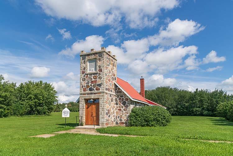
Continue west on #699 to Steele Narrows Provincial Historic Park, about 10 km west of Loon Lake. This was the site of the last skirmish of the 1885 conflict, and is also considered the last military battle to have taken place on Canadian soil. The narrows are named for Sam Steele of the North West Mounted Police.
The battle took place here on June 3, 1885, when Steele’s Scouts encountered some of Chief Big Bear’s Cree camped on the west side of Makwa Lake. Steele and his men had been sent by General Strange of the Canadian militia to follow the Cree and their prisoners after they fled north following the battle at Frenchman Butte. Caught by surprise, at least four Cree were killed. There was to be no more fighting after this skirmish.
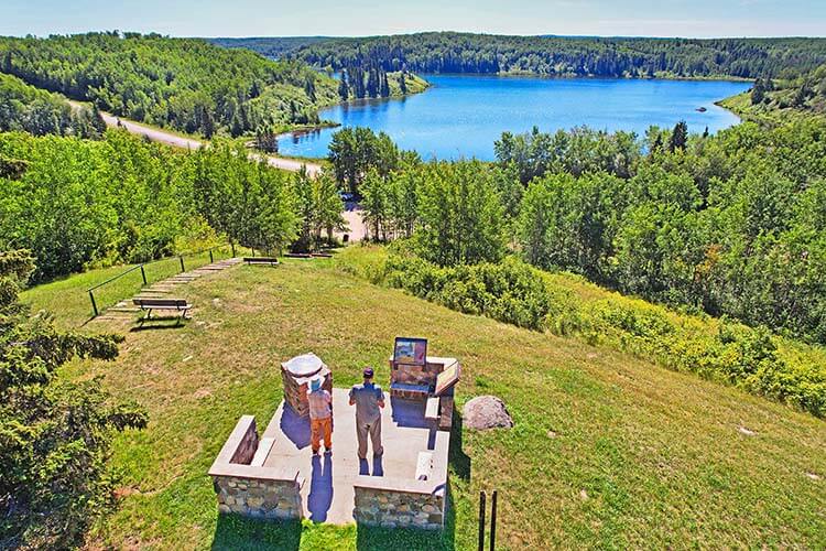
For the best view of the site, climb the steps to the top of the hill. From here it’s easier to visualize how the encounter took place. Maps and interpretive panels provide details about the skirmish.
Just past Steele Narrows the pavement ends, but road #699 becomes a good and wide gravel road continuing west. About 17.5 km along, you reach the intersection with Hwy #21. Heading south along this road you pass a series of lakes in the Bronson Forest Recreation Site, some with resorts and camping.
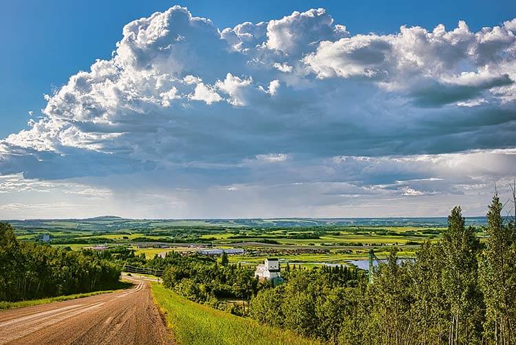
The scenery soon changes as you leave the thick forest. Continuing south you come to the attractive Monnery River Valley. Hwy #21 ends at Hwy #3 just east of the picturesque village of Paradise Hill, which is part of our next driving route.
Touring the Count’s Country
A German Count found this scenic corner of northwest Saskatchewan the ideal place to settle down and practise his art. Artists still come to be inspired, history buffs come to relive the tumultuous last days of the 1885 conflict, and avid birdwatchers are positively aflutter over the wildlife. Add the plethora of lakes a stone’s throw away, and the pleasant countryside is a delight to explore. This circle route begins in St. Walburg (although you could just as easily start in Paradise Hill if you are coming south from Loon Lake) and takes in an amazing variety of history and scenery in a short distance.
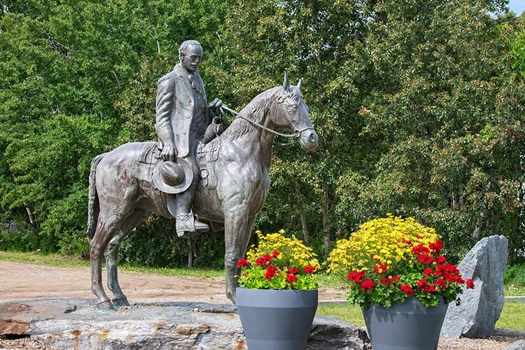
It’s the life-size bronze statue of Count Berthold von Imhoff riding his horse that you first notice upon entering St. Walburg. Born in Germany in 1868, Imhoff excelled as an artist, eventually settling near St. Walburg where he built his home and studio. Until his death in 1939, Imhoff was a prolific artist—mostly religious paintings that adorn many churches throughout Saskatchewan and parts of the United States.
To see some of Imhoff’s work, head to the south end of Main Street to the former Roman Catholic Church where the sanctuary is covered in his murals. The building now houses the St. Walburg & District Historical Museum.
The best place to see his paintings is the Imhoff Gallery housed in the original studio and still operated by the Imhoff family. To get there head south of St. Walburg on Hwy #26, then west on Hwy #26 and follow the signs.
After seeing the gallery, continue west on Hwy #26 to Paradise Hill, a picturesque village built on a hillside. The name originated from two early settlers who succumbed to gold fever and the Klondike gold rush. After a tough trip and no gold, they finally made their way back home, which they likened to returning to paradise.
On your way into town, you can’t miss the gigantic twice-life-size statue of an ox pulling a Red River cart. This was part of the famous Carlton Trail, the major overland route linking Fort Garry (Winnipeg) with Fort Edmonton during the fur trade. The route was later used by settlers who came west using Red River carts.
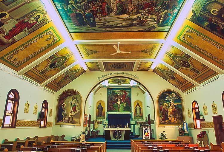
The chief attraction in Paradise Hill is Our Lady of Sorrows Roman Catholic Church where the walls and ceiling are covered in elaborate Imhoff paintings. It’s like walking through a Biblical art gallery, with paintings depicting saints and stories from the Bible, many with gold leaf adding dazzling colour. Most impressive is a large mural of the Crucifixion on the ceiling. To see the inside of the church, call one of the phone numbers posted on the door.
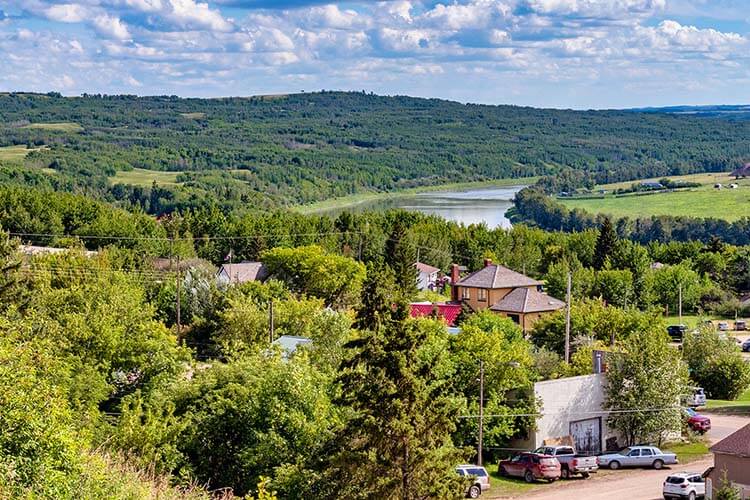
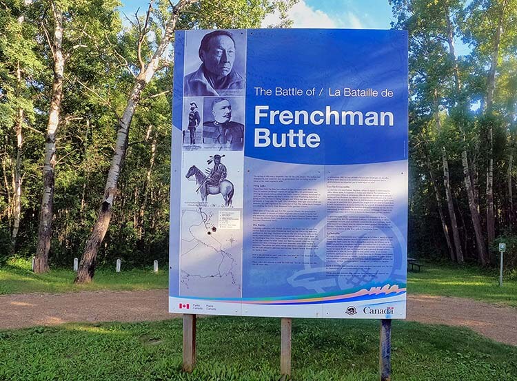
About 9 km west of Paradise Hill along Hwy #3 is the turn-off north to Frenchman Butte. The tiny hamlet is sprawled along the banks of the North Saskatchewan River, giving almost everyone a magnificent view of the river valley.
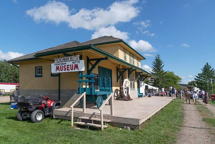
Dominating the community is the expansive Frenchman Butte Heritage Centre and Museum, covering about a city block, a remarkable achievement for such a small community. You can tour the restored CNR station, the caboose, a schoolhouse, Leer family home, and the Lloyd Furman Building dedicated to the museum’s founder. Exhibits take you through the settlement and war years and discuss the role that Fort Pitt and the Frenchman Butte battle site played in the 1885 conflict.
After your visit, be sure to stop for a snack at the Log Cabin Tea House. In August, the annual Frenchman Butte Museum Festival features musicians, a parade, contests, and special displays.
The Frenchman Butte battle site is a short drive to the northeast. From the entrance to the hamlet, head east on #797 for about 2 km to where the highway curves south. From this corner, go north 4.2 km then east for 1.3 km to Frenchman Butte National Historic Site.
A large sign tells you more about the events that took place on the hillside. A short walking trail takes you through the thick forest to a hilltop overlooking an open coulee. On this hillside on May 28, 1885, Wandering Spirit’s followers faced the advancing Canadian militia sent to pursue them.
The drama began on April 2 with what became known as the Frog Lake Massacre, just west of here across the Alberta border, when nine settlers were killed by members of Cree Chief Big Bear’s band. Times were tough for the Cree with many facing starvation. Treaties were signed yet government promises of assistance were slow in coming. Chief Big Bear tried to stop the violence, but his war chief Wandering Spirit and his followers shot the government Indian agent, two priests, and other settlers. The settlers’ wives and others were taken captive.
Wandering Spirit then moved on to nearby Fort Pitt, where a short skirmish took place and the small detachment of North West Mounted Police was forced to leave. The civilians were taken prisoner, then the fort was burned.
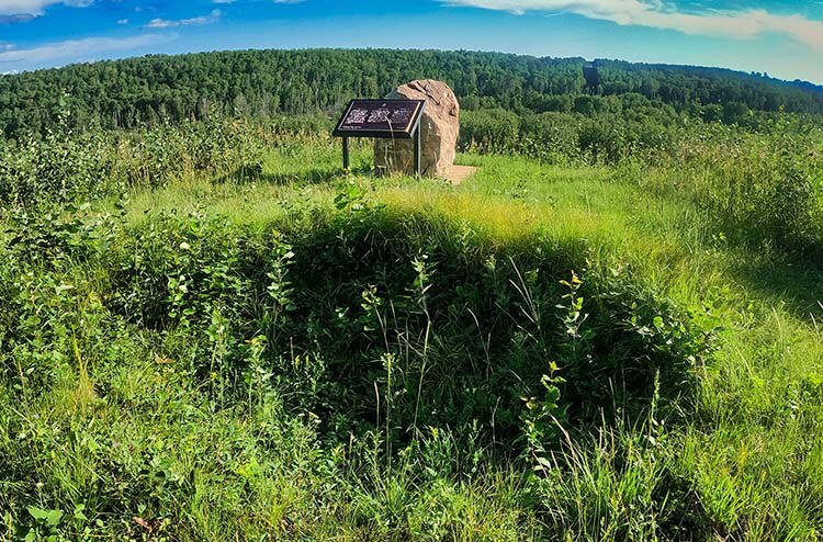
You can still clearly see the series of rifle pits dug by Wandering Spirit’s men, both for defensive positions and for protecting their civilian hostages. Guns blazed on both sides, but the encounter ended in a standoff, as militia commander General Strange realized it would be suicidal to try to cross the open coulee with the Cree so well entrenched in rifle pits.
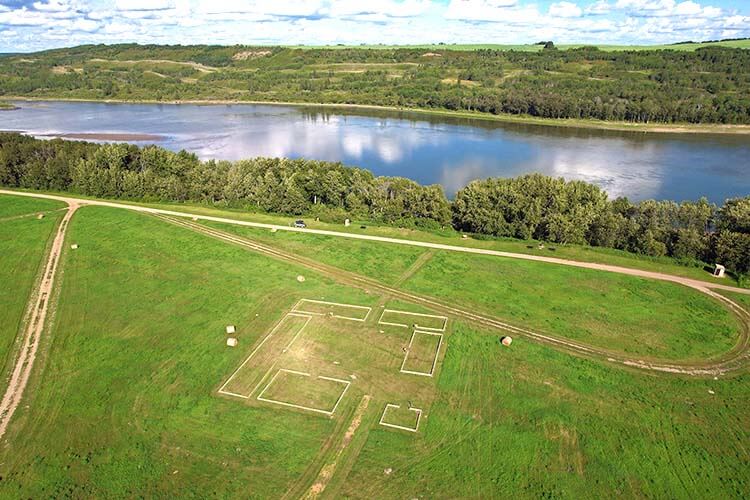
You can visit the former site of Fort Pitt by heading west along grid road #797. Once a prominent Hudson’s Bay Company post, little is left today. Several detailed interpretive panels relate the fort’s significance to the fur trade and its eventual demise during the events of 1885. Timbers outlining some of the buildings provide a better sense of how large the fort was and how it operated.
To return to St. Walburg by another route, return to the Frenchman Butte battle site and keep going east along the grid roads. The route goes through a combination of farmland and wooded areas, then descends into the beautiful Monnery River Valley lined with spruce trees and framed by high hills.
Get the full story
For more comprehensive coverage of these routes, including GPS coordinates and maps, see our recently released book Revised Edition of Saskatchewan’s Best Scenic Drives.
SUBSCRIBE to Photojourneys below.
Feel free to PIN this article on Three Great Road Trips in Northwest Saskatchewan.